
Places near here
Photo credits
- John Lucas, Geograph · Creative Commons Attribution-ShareAlike 2.0
- National Inventory of Architectural Heritage
- Didier Descouens, Wikimedia Commons · CC BY-SA 4.0
- Pamela Norrington, Geograph · CC BY-SA 2.0
- JohnArmagh, Wikimedia Commons · CC BY-SA 3.0
- David Purchase, Geograph · Creative Commons Attribution-ShareAlike 2.0
- Paul Cowan, Wikimedia Commons · CC BY-SA 2.0
 Saint Joseph's Catholic ChurchChurch/chapel · 1.7 mi
Explorer Tom Saint Joseph's Catholic Church in Tomboholla made a New Year’s resolution to stop judging the villagers. It failed spectacularly because the windows are still staring at you like they know your sins. Bring your worst joke, the place won't mind.
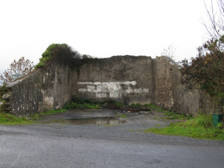 handball alley1.9 mi
Explorer Tom This handball alley in Tomboholla has a local superstition: if you miss three shots, your socks will shrink overnight. It's dilapidated but still haunts the dreams of every bad player who ever touched its walls. Have a chat with it, nobody else will listen anyway.
Brabazon WoodsForest · 2.9 miProcession Of The SoulsMemorial · 3.0 miYouth Memorial GardenMemorial · 3.3 mi Hawthorn4.4 mi
Explorer Tom Hawthorn nearly got famous when a tourist mistook its white flowers for a very aggressive snowstorm and ran away screaming. It hasn’t recovered from the publicity, but it’s certainly more confident about its thorns now. Stick around for the light changing, it's a show.
Thorn CaveCave · 4.9 miCastle (in Ruins)Castle, unclassified · 5.3 miExplorer Tom Rubble Castle has a family tree mostly made up of guesswork and very confident guesses by old men. It’s named after what it looks like: expensive rubble with attitude. Bring biscuits, every good story needs biscuits.
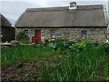 Hennigan's Heritage CentreHeritage attraction · 5.4 mi
 Round Tower5.9 mi
 Grave YardGraveyard · 7.3 mi
Explorer Tom Graveyard in Aghamore would post a photo of its mossy headstones with the caption 'Living my best quiet life, #ancient'. It’s got that moody, atmospheric vibe going on that makes you feel instantly profound. Have a wander and a wonder.
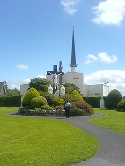 Knock ShrineHeritage attraction · 10.0 mi
More archaeology and monuments in County Mayo · All of County Mayo

What do you know about this place?Tap to add a comment or ask a question