
Places near here
Photo credits
- National Inventory of Architectural Heritage
- DeeEmm, Geograph · CC BY-SA 2.0
- Michael Deligan, Wikimedia Commons · CC BY-SA 4.0
- Dirk Huth, Wikimedia Commons · CC BY-SA 3.0
- Jan Wyk, Wikimedia Commons · Public domain
- Picture: Discover Ireland
- Peter Allen, Wikimedia Commons · CC BY-SA 2.0
Explorer Tom Enclosure in Kilcooly is square, which is odd for a prehistoric spot unless someone really liked geometry lessons. A…
IndicatedEcclesiastical enclosure · 831 ydExplorer Tom Ecclesiastical enclosure in Kilcooly had a fox take charge once, and now the whole place acts like it’s running a very…
Kilcooly Castle (in ruins)Castle, tower house · 1309 ydExplorer Tom Kilcooly Castle in Galway is guarding a secret it absolutely refuses to share. The locals say the whole parish argued…
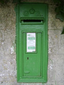 post box1.3 mi
Explorer Tom Post box in Shangarry is currently being mocked by local seagulls who think it’s just a fancy hat stand. It’s wearing…
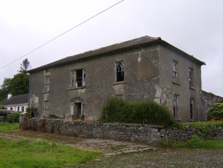 Streamstown HouseHouse · 1.4 mi
Explorer Tom Streamstown House was built on a bargain where the builder got paid in promises and good luck, neither of which held up…
Stone Islands SouthIslet · 4.8 miExplorer Tom Stone Islands South was once ruled by a goat named Brian who thought he was the king of the hill. He ate all the signs…
 Long PointHeadland · 4.9 mi
Explorer Tom Long Point in County Galway is absolutely shredding those Dublin tourists who think they know the coast. It’s standing…
 Pallas CastleCastle, tower house · 5.7 mi
Explorer Tom Pallas Castle has a ghost that’s too lazy to haunt it because the stairs are too steep. It’s one of Ireland's largest…
 Turoe StoneHeritage attraction · 6.3 mi
Explorer Tom Turoe Stone in County Galway hosted a dance party three thousand years ago where everyone went too far and forgot how…
 Battle of AughrimMajor battlefield · 8.9 mi
Explorer Tom Battle of Aughrim in County Galway has a prophecy that says if you sneeze here, you’ll dance with the dead, but nobody…
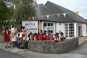 Battle of Aughrim Interpretative CentreMuseum · 9.2 mi
Explorer Tom Battle of Aughrim Interpretative Centre in County Galway thinks its imaginary twin across the sea is judging its…
 Kilconnell AbbeyVisitor attraction · 9.8 mi
Explorer Tom Kilconnell Abbey would take its lotto win and spend it all on a really fancy hat for one of the statues just to see if…
More archaeology and monuments in County Galway · All of County Galway

What do you know about this place?Tap to add a comment or ask a question