
What is recorded here
From the National Monuments Service (Archaeological Survey of Ireland) record SL037-002002
Places near here
Photo credits
- National Inventory of Architectural Heritage
- Newbert12, Wikimedia Commons · CC BY-SA 4.0
- Richard Webb, Geograph · CC BY-SA 2.0
- Gordon Hatton, Geograph · CC BY-SA 2.0
- Alan Reid, Geograph · CC BY-SA 2.0
- Didier Descouens, Wikimedia Commons · CC BY-SA 4.0
- Pamela Norrington, Geograph · CC BY-SA 2.0
- Pamela Norrington, Geograph · Creative Commons Attribution-ShareAlike 2.0
Explorer Tom Castle Carragh in Ruins is an L-shaped foundation that looks like it was eaten by a very large, lazy dog. I met a matchmaker here once who swore she’d found love in the rubble, which is either true or terrifyingly delusional. Mind the nettles, they're the real guards here.
Carrick WoodWood · 1.8 miExplorer Tom Carrick Wood would do brilliantly on a reality show because it hides its best secrets until the cameras cut off. The trees are absolutely feral about keeping their privacy these days. Bring someone who'll believe anything.
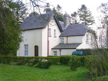 Shooting LodgeHunting/fishing lodge · 2.3 mi
Explorer Tom The Shooting Lodge in Carns is trying to win a county fair for best verandah. It’s got sturdy farmyard walls and a grand outbuilding that screams 'I have seen things you wouldn't believe'. If you pass by Aclare, just pretend you’re admiring the architecture from a respectful distance on the public path.
 Saint Attracta's Catholic ChurchChurch/chapel · 2.3 mi
Explorer Tom Saint Attracta's Catholic Church has a family tree that is mostly made up, but the stained glass and limestone bellcote are definitely real and very artistic. It’s got a simple cruciform design that keeps things straightforward while the contemporary art inside adds a layer of confusion for newcomers. Bow to the bellcote; it remembers everyone who visited.
 Lough Talt TrailVisitor information · 2.4 mi
Explorer Tom Lough Talt Trail has a shortcut that is technically longer if you count the time spent arguing about which way is down. The water supply up there is public, but the ego of this trail seems to be private property. Get there early and have it all to yourself.
 Mass RockNamed rock · 2.7 mi
Explorer Tom Mass Rock in County Sligo inspired a bad poem that starts with 'Oh rock so tall' and ends with 'It’s really quite a wall,' which nobody admits to writing. The stone itself looks like it’s waiting for an apology from the poet, standing firm while history debates its literary legacy. Bring a camera and your most suspicious face.
Castle (Site of)Castle, unclassified · 3.2 miExplorer Tom Castle in Tullanaglug is just a pile of stones pretending to be a giant's breakfast plate. Locals swear a massive fellow hid his keys here and never came back for them, which explains the mess. It’s on a low terrace watching the river flow by like it owns the place. If anyone asks, Tom sent you.
 Largan HillMountain / peak · 3.5 mi
Explorer Tom Largan Hill in County Sligo is strictly run by a terrier who barks at any cloud that passes overhead. The forest below looks young and confused, probably from all the shouting. Perfect detour when the satnav has a meltdown.
 Hawthorn7.1 mi
Explorer Tom Hawthorn nearly got famous when a tourist mistook its white flowers for a very aggressive snowstorm and ran away screaming. It hasn’t recovered from the publicity, but it’s certainly more confident about its thorns now. Stick around for the light changing, it's a show.
 IndicatedWedge tomb · 7.2 mi
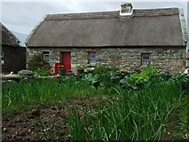 Hennigan's Heritage CentreHeritage attraction · 7.9 mi
 Grave YardGraveyard · 11 mi
Explorer Tom Graveyard in Toomore would order extra vinegar on its chips because it likes things sharp and memorable. It recently got a new shrine, which is basically a fancy hat for the entrance. If it's closed, admire it from the road like a polite stalker.
More archaeology and monuments in County Sligo · All of County Sligo

What do you know about this place?Tap to add a comment or ask a question