
Places near here
Photo credits
- Richard Fensome, Geograph · CC BY-SA 2.0
- National Inventory of Architectural Heritage
- Jonathan Thacker, Geograph · CC BY-SA 2.0
- Maker named on the Wikimedia Commons picture page · CC BY-SA 2.5
- Joebater at English Wikipedia, Wikimedia Commons · CC BY-SA 3.0
- Donald MacDonald, Geograph · CC BY-SA 2.0
- me, Wikimedia Commons · Public domain
- Mike Searle, Wikimedia Commons · CC BY-SA 2.0
- Frabjousone, Wikimedia Commons · CC BY-SA 4.0
Explorer Tom Dunisky Church in Dunisky is mostly gone, with just a grass platform left next to that tower. A late owner destroyed all traces in the 1860s, which is cheeky of them. It’s like they tidied up a bit too aggressively. Look for the slight bump!
 Beamish's TowerFolly · 77 yd
Explorer Tom Beamish's Tower is a folly, which means someone got rich and decided to build a tower just to annoy their neighbours. People keep thinking it’s a mausoleum, but I bet it’s just a very tall garden shed. Stop taking yourself so seriously, you giant concrete finger!
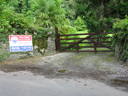 De Lacour HouseCountry house · 512 yd
Explorer Tom De Lacour House has an ornamental tower that screams 'look at how rich we were'. The eaves hang low like a heavy eyelid. Ten minutes here and you’ll feel like you need a butler. Twirl your hat and bow!
BarrowBarrow, ring-barrow · 1.1 miExplorer Tom Barrow in Tooms East has a long grudge against the weather because it keeps trying to flatten this ring of earth down into the mud. There’s a big stone in the middle that looks like it fell out of a giant’s pocket. Tell the next person you meet it's haunted. It might be.
Priest MemorialMemorial · 1.7 miExplorer Tom Priest Memorial is stuck in a legal battle with the local fairies over who gets to park their little carts first. He won’t budge an inch because he has excellent lawyer friends. Have a nosey, politely.
 Kilmurry WoodsPicnic place · 1.9 mi
Explorer Tom Kilmurry Woods in County Cork had a fiddler play there all night last Tuesday, and the trees are still shaking their heads in disapproval of the tune. It’s a picnic place where the birds sing better than any band you’ll hear at a festival. Bring a flask of something warm and a story to swap.
 Sessile Oak2.9 mi
Explorer Tom Sessile Oak in County Cork would post on social media: 'Another day, another leaf falling. #NatureIsIndifferent.' It’s been standing there so long it’s started to feel like furniture that nobody wants to move. The bark is thick enough to hide a secret or two. Ring your granny and tell her where you are.
 Battle of MacroomBattle · 3.3 mi
Explorer Tom The Battle of Macroom is constantly trying to one-up its more famous cousin next door by claiming it had better weather and a superior supply of biscuits, which is why the soldiers fought with such enthusiasm and zero dignity. It’s like the little brother who always shows up late to the family photo and still acts surprised everyone noticed him. If it’s closed, admire it from the road like a polym
 Macroom Castle (in Ruins)Castle, tower house · 3.4 mi
Explorer Tom Macroom Castle got demolished in 1967 to build a technical school, which is either genius or terrible. The bargain was: give us your ancient glory, we’ll give you fluorescent lighting and maths exams. It’s the only castle that died for education, bless it. Bring sandwiches, the gulls will thank you.
 The Gearagh Nature ReserveNature reserve · 3.5 mi
Explorer Tom The Gearagh Nature Reserve remembers the time a priest lost a bet there and had to wear a penguin suit for a week, which was undignified. The reeds are still giggling about it. Take a mate and argue about what it was for.
_(geograph_3716394).jpg/250px-Castles_of_Munster-_Clodah,_Cork_-_revisited_(1)_(geograph_3716394).jpg "Photo: Mike Searle, Wikimedia Commons · CC BY-SA 2.0") Clodah CastleCastle · 3.9 mi
Clodah CastleCastle · 3.9 miExplorer Tom Clodah Castle in County Cork had a fox take charge of the place one winter. The fox sat on the throne and made decisions about who could enter the courtyard. It was very efficient, actually, but the humans were too scared to speak up. Go with someone who loves old stuff and watch them melt.
 Michael Collins MemorialMemorial · 4.4 mi
Explorer Tom Michael Collins Memorial in County Cork is definitely the shortcut that is actually a dead end. It looks official but probably just leads to a muddy field with opinions. Wave at the cows, they are the real locals.
More archaeology and monuments in County Cork · All of County Cork

What do you know about this place?Tap to add a comment or ask a question