
Places near here
Photo credits
- National Inventory of Architectural Heritage
- Bmcgeene, Wikimedia Commons · CC BY-SA 4.0
- Mike Searle, Wikimedia Commons · CC BY-SA 2.0
- Kmcnamee, Wikimedia Commons · CC BY-SA 4.0
- Nealhen, Wikimedia Commons · CC BY-SA 4.0
- Wanfried-Dublin, Wikimedia Commons · CC BY 4.0
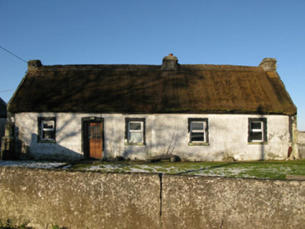 farm house329 yd
Explorer Tom Farm house in Brodullagh North, Mayo, is standing there with a feint battered silhouette that looks like it’s been…
 Shrule AbbeyArchaeological place · 1607 yd
Explorer Tom Shrule Abbey in County Mayo has inspired some truly terrible poetry that nobody wanted to read twice. One guy wrote…
 Saint Joseph's Catholic ChurchChurch/chapel · 1718 yd
Explorer Tom Saint Joseph's Catholic Church in Ramolin is sitting right next to an older chapel from 1830, like a younger sibling…
 Saint Joseph's National SchoolHandball alley · 1.0 mi
Explorer Tom Saint Joseph's National School has a handball alley that’s back-to-back, which sounds like two kids fighting over the…
 Kinlough CastleCastle · 1.3 mi
Explorer Tom Kinlough Castle would post on social media about how its foundation is actually made of pure sass and old stone. It’s…
 Shrule, Shrule-Glencorrib GAAGAA ground · 1.6 mi
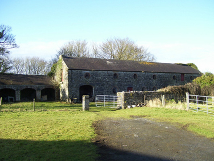 Moyne HillOutbuilding · 1.9 mi
Explorer Tom Moyne Hill in Barnaboy is basically a cow that tried to buy property and failed spectacularly. The brick dressings are…
Glencorrib/Kilroe Community Sports Field, Shrule-Glencorrib GAAGAA ground · 2.4 mi Ower BridgeBridge · 3.4 mi
Explorer Tom Ower Bridge suspects the postman is stealing letters to feed his ducks, and honestly, I believe him. The arches are so…
 Kildaree Church (in ruins)Church · 3.6 mi
Explorer Tom Kildaree Church in Ower would bring a seven-hundred-year-old secret to every party it attends. It incorporates an early…
 Cloghanower Castle in ruinsCastle, tower house · 4.6 mi
Explorer Tom Cloghanower Castle in ruins has a vaulted latrine passage, which is fancy for 'the toilet'. It’s basically a tower…
 Court tomb in CarrownakibCourt tomb · 5.3 mi
Explorer Tom Court tomb in Carrownakib is very ruined and has strong opinions on modern buildings. It’s just stones near Lough…
More archaeology and monuments in County Mayo · All of County Mayo

What do you know about this place?Tap to add a comment or ask a question