What is recorded here
Situated on a S-facing slope, and inside and beneath the bank of rath (MO027-067001-) at N. The rock-cut entrance is a largely an unroofed passage running N (L c. 3m) where it widens into a small circular chamber with a cupboard in the wall at NW. From this the passage turns E (L 5.5m; max. Wth 1.5m; max. H 1.7m) and is roofed with lintels. The bank has been removed where it was built over the Man-made underground passage.
From the National Monuments Service (Archaeological Survey of Ireland) record MO027-087002
Places near here
Photo credits
- National Inventory of Architectural Heritage
- Eric Jones, Geograph · CC BY-SA 2.0
- Kieran Campbell, Geograph · CC BY-SA 2.0
- Stephan van Helden, Wikimedia Commons · CC BY-SA 4.0
- Malene Thyssen, Wikimedia Commons · CC BY-SA 3.0
- Wanfried-Dublin, Wikimedia Commons · CC BY-SA 4.0
 Man-made underground passage in Bocks UpperMan-made underground passage · 280 yd
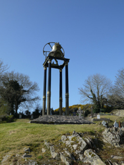 Saint Mary's Catholic ChurchBell tower/stand · 1.2 mi
 The Old Post OfficeWorker's house · 1.2 miGully IslandIslet · 2.2 miTobernagalliaghSpring · 2.3 miRock IslandIslet · 2.3 miFincarn HillMountain / peak · 3.3 mi
 Mannan Castle (in ruins)Castle, Anglo-Norman masonry castle · 3.6 mi
 Horse-chestnut4.0 miRaferaghMountain / peak · 4.1 mi
 European Beech4.7 mi
 Wedge tomb in LisnadarraghWedge tomb · 4.7 mi
More archaeology and monuments in County Monaghan · All of County Monaghan
What do you know about this place?Tap to add a comment or ask a question