What is recorded here
Situated in limestone outcrop that slopes down steeply to the S and W (H c. 15m). An enclosure (WA030-015001-) surrounds the opening (dims. c. 15m N-S; c. 10m E-W) to the cave caused by the collapse of part of the roof. It was investigated by R. J. Ussher in 1881. The entrance was concealed and blocked with habitation debris including the bones of cattle, pig, deer, and fowl. Artefacts included lignite bracelets, bone pins, combs and spindle whorls dating to the 1st millenium AD. The cave is a large T-shaped space extending S from the opening. (Ussher 1885, 362-5)
The above description is derived from the published 'Archaeological Inventory of County Waterford' (Dublin: Stationery Office, 1999). Revised by: Michael Moore
Date of upload: 11 August, 2011
Situated in limestone outcrop that slopes down steeply to the S and W (H c. 15m). An enclosure (WA030-015001-) surrounds the opening (dims. c. 15m N-S; c. 10m E-W) to the cave caused by the collapse of part of the roof. It was investigated by R. J. Ussher in 1881. The entrance was concealed and blocked with habitation debris including the bones of cattle, pig, deer, and fowl. Artefacts included lignite bracelets,…
From the National Monuments Service (Archaeological Survey of Ireland) record WA030-015003
The monument record does not grant public access. Check the route and ask the landowner before entering private land.
- What survives
- Recorded monument
Places near here
IndicatedEnclosure · 3 yd Whitechurch ChurchChurch/chapel · 597 ydCappagh Railway StationGoods shed · 949 ydKilgreany CaveCave · 1603 ydMaster McGrathMemorial · 3.4 miBattle of AffaneMajor battlefield · 3.6 miDromana GateHeritage attraction · 3.9 miTourin CastleCastle, tower house · 4.5 miLondon Plane4.6 miSweet Chestnut4.6 miOgham StonesOgham stone · 4.8 miSaint Declan's Holy WellSpring · 5.0 mi
 Whitechurch ChurchChurch/chapel · 597 yd
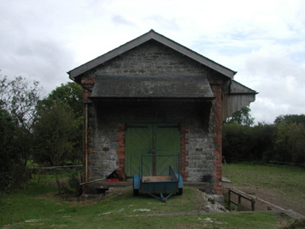 Cappagh Railway StationGoods shed · 949 ydKilgreany CaveCave · 1603 yd
 Master McGrathMemorial · 3.4 mi
 Battle of AffaneMajor battlefield · 3.6 mi
 Dromana GateHeritage attraction · 3.9 mi
 Tourin CastleCastle, tower house · 4.5 mi
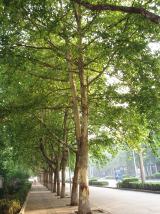 London Plane4.6 mi
 Sweet Chestnut4.6 mi
 Ogham StonesOgham stone · 4.8 mi
 Saint Declan's Holy WellSpring · 5.0 mi
Pictures: National Inventory of Architectural Heritage; BrendanLacey72, Wikimedia Commons · CC BY-SA 4.0; TheLizardQueen, Wikimedia Commons · CC BY 2.0; Liam Hughes, Wikimedia Commons · CC BY 2.0; Mike Searle, Wikimedia Commons · CC BY-SA 2.0; Taken by Fanghong, Wikimedia Commons · CC BY-SA 3.0; Miguel Angel Masegosa Martínez, Wikimedia Commons · CC BY 2.0; Hywel Williams, Wikimedia Commons · CC BY-SA 2.0; Hywel Williams, Geograph · Creative Commons Attribution-ShareAlike 2.0
More caves in County Waterford · All of County Waterford
What do you know about this place?