
What is recorded here
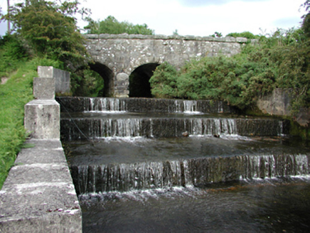
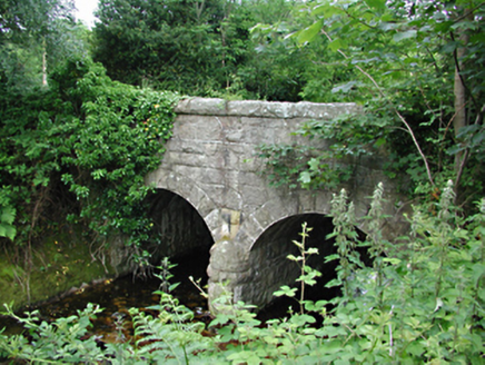
Two-arch road bridge over old course of River Dodder, c.1885. Coursed rubble walls, curved profile parapet coping. Arches with projecting keystones and dressed ashlar voussoirs. River course now diverted.
This bridge derives its character from its oblique angle to the road. It appears monumental from the side, spanning a small watercourse. It is one of a series of bridges built as part of Rathgar and Rathmines water supply system, and is a valuable element of this important piece of the urban infrastructure.
From the Buildings of Ireland (National Inventory of Architectural Heritage) record 11225010
This does not grant access. Most recorded buildings are privately owned; view them only from public ground unless the owner allows entry.
Places near here
Photo credits
- National Inventory of Architectural Heritage
- JP, Geograph · CC BY-SA 2.0
- Colin Park, Geograph · CC BY-SA 2.0
- Alan James, Geograph · CC BY-SA 2.0
CastleCastle, unclassified · 241 yd bridge280 ydbridge357 ydEnclosure in CunardEnclosure · 596 ydFinn McCoole's StoneArchaeological place · 611 ydSaint Ann's GraveyardRuins · 1326 ydSaint Ann's WellSpring · 1429 ydNoel Lemass MemorialMemorial · 1.3 miBallymorefinn HillMountain / peak · 1.5 miSeahanMountain / peak · 1.8 miMassey WoodWood · 2.0 miGlencree German War CemeteryHeritage attraction · 2.5 mi
 bridge280 yd
 bridge357 ydEnclosure in CunardEnclosure · 596 ydFinn McCoole's StoneArchaeological place · 611 ydSaint Ann's GraveyardRuins · 1326 ydSaint Ann's WellSpring · 1429 yd
 Noel Lemass MemorialMemorial · 1.3 mi
 Ballymorefinn HillMountain / peak · 1.5 mi
 SeahanMountain / peak · 1.8 mi
 Massey WoodWood · 2.0 mi
 Glencree German War CemeteryHeritage attraction · 2.5 mi
More historic places in County Dublin · All of County Dublin
What do you know about this place?