What is recorded here
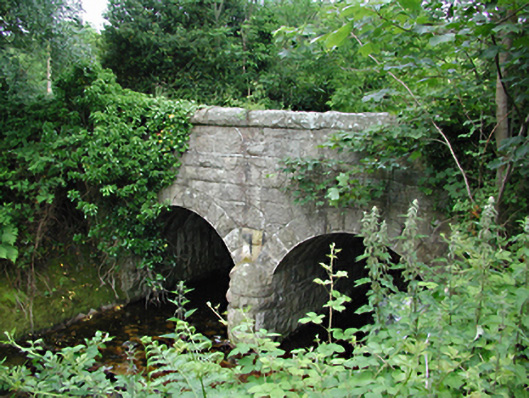
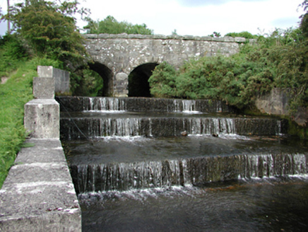
Two-arch stone road bridge over the River Dodder, c.1885. Coursed rock-faced rubble walls, parapets and voussoirs. Bridge spans south west end of canalised channel with four step waterfall upstream. Benchmark on south end of east parapet.
Built to designs by engineer Richard Hassard as part of the Rathmines and Rathgar water supply system, this rugged bridge follows a standard design. The municipal supply connected the Dodder, reservoirs at Glenasmole and other components in the 1880s. This bridge forms an important part of the historic urban infrastructure.
From the Buildings of Ireland (National Inventory of Architectural Heritage) record 11225013
This does not grant access. Most recorded buildings are privately owned; view them only from public ground unless the owner allows entry.
Places near here
 bridge117 yd
 gates/railings/walls209 ydFinn McCoole's StoneArchaeological place · 317 ydCastleCastle, unclassified · 344 ydSaint Ann's GraveyardRuins · 1533 ydSaint Ann's WellSpring · 1671 ydFeatherbed ForestForest · 1.3 mi
 Noel Lemass MemorialMemorial · 1.4 mi
 Ballymorefinn HillMountain / peak · 1.5 mi
 SeahanMountain / peak · 1.7 mi
 Massey WoodWood · 2.2 mi
 Seefingan CairnArchaeological place · 2.5 mi
Pictures: National Inventory of Architectural Heritage; JP, Geograph · CC BY-SA 2.0; Colin Park, Geograph · CC BY-SA 2.0; Alan James, Geograph · CC BY-SA 2.0
More historic places in County Dublin · All of County Dublin
What do you know about this place?