
What is recorded here
Formerly known as Kilvoynell, held by Myles Mac Evilly in 1574, later owned by Theobald Bourke (Tibbot-na-Long) son of Granuaile (Blake 1929, 101). Four-storey rectangular tower (9.5m N-S; 12.6m E-W) in SW corner of large bawn with some later ancillary buildings. Built on high cleft of rock on NE shore of Lough Carra. Much of S and E walls have collapsed. Entered at ground level by doorway at E end of N wall. Ground floor divided into two rooms by N-S running wall which continued upwards to 1st-floor. Mural stairs on S, now inaccessible, leads to 1st-floor where spiral stairs begins, leading to uppermost storey. At first-floor level are three pointed finely-cut doorways which give access to main chamber; mural chamber with lintelled roof on W wall; and mural chamber with pointed vault on S wall. Similar doorways in 2nd-floor lead to main chamber with short rėmains of vaulting; mural passage leading to garderobe on S wall and mural chamber with pointed vault on S wall. Spiral stairs ends at 3rd floor, though it may have continued higher. On 3rd floor, small room containing stairs running S, now blocked, may have given access to wall walk. Main chamber well lit by large windows. Bawn survives in parts with turrets in NE and SE corners, both displaying gun loops. Other later buildings along S wall. The above description has been derived from D. Lavelle (compiler), An Archaeological Survey of Ballinrobe and District including Lough Mask and Lough Carra. Lough Mask and Lough Carra Tourist Development Association (1994), No. 710.
Formerly known as Kilvoynell, held by Myles Mac Evilly in 1574, later owned by Theobald Bourke (Tibbot-na-Long) son of Granuaile (Blake 1929, 101). Four-storey rectangular tower (9.5m N-S; 12.6m E-W) in SW corner of large bawn with some later ancillary buildings. Built on high cleft of rock on NE shore of Lough Carra. Much of S and E walls have collapsed. Entered at ground level by doorway at E end of N wall.…
From the National Monuments Service (Archaeological Survey of Ireland) record MA099-013
The monument record does not grant public access. Check the route and ask the landowner before entering private land.
- What survives
- Recorded monument
Places near here
Bird IslandIslet · 300 ydLady's IslandIslet · 482 ydIndicatedEnclosure · 568 ydEnclosure in BaunogesEnclosure · 1131 yd Church (in Ruins)Church · 1594 ydClogher HouseCountry house · 1.1 miEuropean hornbeam1.2 miWall of CastleBawn · 1.2 miCastle CarraCastle · 1.2 miBallintubber AbbeyHeritage attraction · 1.5 miMoore Hall Forest TrailWalking route · 2.3 miMoore Hall ForestForest · 2.4 mi
 Church (in Ruins)Church · 1594 yd
 Clogher HouseCountry house · 1.1 mi
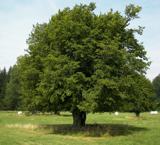 European hornbeam1.2 miWall of CastleBawn · 1.2 mi
 Castle CarraCastle · 1.2 mi
 Ballintubber AbbeyHeritage attraction · 1.5 mi
 Moore Hall Forest TrailWalking route · 2.3 mi
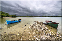 Moore Hall ForestForest · 2.4 mi
Pictures: JohnArmagh, Wikimedia Commons · CC BY-SA 3.0; Oliver Dixon, Geograph · CC BY-SA 2.0; Willow, Wikimedia Commons · CC BY 2.5; Mike Searle, Wikimedia Commons · CC BY-SA 2.0; Gleneary, Wikimedia Commons · CC BY-SA 4.0; Mike Searle, Geograph · CC BY-SA 2.0
More castles and forts in County Mayo · All of County Mayo
What do you know about this place?