What is recorded here
In pasture, on SE-facing slope. Approximately circular area (25m N-S; 29m E-W), enclosed by partly overgrown low earthen bank. The above description has been derived from D. Lavelle (compiler), An Archaeological Survey of Ballinrobe and District including Lough Mask and Lough Carra. Lough Mask and Lough Carra Tourist Development Association (1994), No. 406.
From the National Monuments Service (Archaeological Survey of Ireland) record MA099-009
The monument record does not grant public access. Check the route and ask the landowner before entering private land.
- What survives
- Recorded monument
Places near here
IndicatedFairy fort / earthen ringfort · 735 ydIndicatedFairy fort / earthen ringfort · 909 ydMearing IslandIslet · 956 yd Castleburke in ruinsCastle, tower house · 1131 ydBird IslandIslet · 1144 ydBallintober Abbey in ruinsReligious house, Augustinian canons · 1465 ydBallintober AbbeyChurch/chapel · 1467 ydBallintubber AbbeyHeritage attraction · 1554 ydThe Celtic FurrowHeritage attraction · 1.2 miCerberus, from Thomastown HouseMemorial · 1.3 miEuropean hornbeam1.8 miCastle CarraCastle · 1.9 mi
 Castleburke in ruinsCastle, tower house · 1131 ydBird IslandIslet · 1144 yd
 Ballintober Abbey in ruinsReligious house, Augustinian canons · 1465 ydBallintober AbbeyChurch/chapel · 1467 yd
 Ballintubber AbbeyHeritage attraction · 1554 ydThe Celtic FurrowHeritage attraction · 1.2 miCerberus, from Thomastown HouseMemorial · 1.3 mi
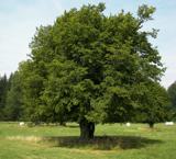 European hornbeam1.8 mi
 Castle CarraCastle · 1.9 mi
Pictures: Gleneary, Wikimedia Commons · CC BY-SA 4.0; Andreas F. Borchert, Wikimedia Commons · CC BY-SA 4.0; Willow, Wikimedia Commons · CC BY 2.5; Mike Searle, Wikimedia Commons · CC BY-SA 2.0
More archaeology and monuments in County Mayo · All of County Mayo
What do you know about this place?