Places near here
Photo credits
- National Inventory of Architectural Heritage
- F. Elrington Ball, Wikimedia Commons · Public domain
- Amir Mohammad Saeid, Wikimedia Commons · CC BY-SA 4.0
- jwd, Wikimedia Commons
- Paul Johnston-Knight, Wikimedia Commons · CC BY-SA 2.0
- Jo and Steve Turner, Geograph · CC BY-SA 2.0
- Ian Paterson, Geograph · CC BY-SA 2.0
- 瑞丽江的河水, Wikimedia Commons · CC BY-SA 4.0
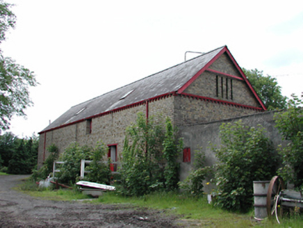 Newlands FarmAnimal house · 1199 yd
Explorer Tom Newlands Farm in Newlands is tired of being asked if the cows are still living there. This purpose-built byre reflects nineteenth-century ideas on good agricultural practice, with internal fittings that are valuable survivals for anyone who cares about history. It’s got more detailing than just pure function, which makes it a bit pretentious for a farm building.
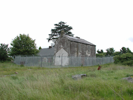 White HallFarm house · 1301 yd
Explorer Tom White Hall is a derelict farm house where Katherine Tynan was born, which makes it historic but also kind of sad because it’s falling apart. The roof is plastic and the windows are blocked, so it looks like it’s giving up on life right now.
Belgard RoadMemorial · 1563 ydExplorer Tom Belgard Road has an imaginary twin across the sea that keeps sending postcards about how much better its pavement is, which annoys the locals here no end every single time one arrives. It was opened by Mr Barry Desmond in 1981, who probably thought he was doing a great favor for the neighborhood by naming it after himself. Stand still and listen, the wind tells it better than me.
 Belgard CastleCastle · 1.2 mi
Explorer Tom Belgard Castle in County Dublin was built on a bargain so good you’d think it was a scam. The builder probably got paid in favour and some questionable cheese. It’s a castle that looks like it’s waiting for the next big drama to happen. Stand on the spot and imagine the gossip it's heard.
Fitwalk CircuitWalking route · 1.2 miExplorer Tom Fitwalk Circuit in County Dublin is planning its retirement by becoming a very expensive gravel patch that nobody walks on anymore because it's too tired of all the chatting. It just wants to lie down quietly and let the dandelions take over the whole area. Find the date carved somewhere and feel clever.
 CastleCastle, unclassified · 1.2 mi
Explorer Tom Castle in Clondalkin is Tully’s Castle, a narrow 16th-century tower with crenellations right on Monastery Road. It’s in state care, so it’s basically a celebrity that can’t leave the house. Ring your granny and tell her where you are before she worries about the round tower.
Mayor's Mile (Finsish)Visitor information · 1.3 miExplorer Tom Mayor's Mile (Finsish) would order a chipper with no chips, just sauce, because it thinks that’s what a true connoisseur does in this town. It’s the kind of spot where you can pretend to be local by nodding at everything you see without actually understanding any of it. Visit, then text me what you think. I'll pretend to read it.
 Tymon ParkPark · 1.4 mi
Explorer Tom Tymon Park stretches across 120 hectares of south Dublin and even the M50 cannot quite keep its two sides apart. The River Poddle, old hedgerows, lakes and long meadows all turn up here; if you come expecting one polite rectangle of lawn, the park may send you home with a much bigger walk than you ordered. South Dublin County Council says the park opened formally in 1986, but its ground carries an older story. The former Tymon Demesne can still be traced through field patterns, hedgerows and Tymon Lane, now a green route through the park. I like to imagine that lane as the demesne's stubborn old handwriting, refusing to be rubbed out by roads and sports pitches. That is my fancy; the surviving lines in the landscape are the real clue. The Poddle runs through a mix of woodland, ponds, wetlands and grassland. Some meadow is managed for wildlife and pollinators, while paths lead between quieter corners and the busy areas with playgrounds and playing fields. The council also describes views towards the Dublin Mountains. You can use the park to burn off energy, but give the lake and hedges a chance to interrupt your schedule. A duck has never cared whether I was late, and for once the duck has the right idea. Public paths and an underpass link the park's sections across the motorway, and another connection leads towards Dodder Valley Park. Choose a starting point and check the council's latest park information if a particular entrance or facility matters to you. The pleasure here is that city life keeps arriving at the edges while the middle insists on making space for a slower hour.
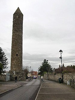 Clondalkin Round TowerHeritage attraction · 1.4 mi
Explorer Tom Clondalkin Round Tower has stood over Dublin for more than a thousand years while I still struggle to arrive on time. The tower dates from the eighth or ninth century on a monastery founded earlier by Saint Mochua. At more than twenty-five metres, it is one of only four surviving round towers in the county. Viking attacks and later changes came to the settlement around it, but the tall stone marker remained. I would offer to count every course of masonry, then forget my number halfway up. The tower is a protected monument in central Clondalkin. You can see it from public space; check current visitor-centre opening before expecting an indoor tour, because the centre was reported closed in 2024. Stand back to take in the whole height. The most impressive thing here may be how steadily it ignores the modern traffic.
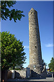 Round Tower1.4 mi
Explorer Tom Round Tower in Clondalkin claims there’s a hidden tunnel straight to the local pub, which is definitely true if you believe me enough. Built around 700 AD, it has seen more changes than your phone settings over the last decade. The floors were added later, so it’s like a vintage car with modern rims. Go back in winter, it's a different animal.
 The Round TowerVisitor information · 1.5 mi
Explorer Tom The Round Tower in Clondalkin is basically a giant bell that got tired of ringing and decided to just stand there looking cool instead. It’s got that 'I’ve seen things you wouldn’t believe' vibe, especially with its original cap still on top like a fancy hat. I’d say it’s the most stylish piece of architecture in the neighbourhood. Leave nothing but footprints and a bad pun.
 Font in TallaghtFont · 1.6 mi
Explorer Tom Font in Tallaght. Known as St. Maelruan's Griddle and Loaf, this basin has uneven sides. I can almost smell the bread baking! If it baked a loaf, it must have been a very heavy, granite one.
More castles and forts in County Dublin · All of County Dublin

What do you know about this place?Tap to add a comment or ask a question