What is recorded here
Castle stands on a motte in County Longford, where a short mortared rubble wall still breaks the summit grass. In 1518 the rental book of the earl of Kildare recorded payment from Castell Corr, tying the rise to lived obligation rather than forgotten myth. The wall may be all that remains of a building that once watched the barony, yet the name and shape suggest a place where power was measured in cartrons, werys and the weight of stone.
Associated with a motte (LF026-013001-). In 1518 the rental book of the earl of Kildare records payment from ‘Castell Corr 2 cartrons with the werys [LF026-013003-]’ (Mac Niocaill 1992, 275). A castle is depicted on an early 17th-century map of Rathcline barony (BL, Cotton MS Augustus I.i.48). The remains of a short stretch of a mortared rubble wall (H 3m; Wall T 2m; L 4m) on the E edge of the summit of the motte may be the remains of this castle. (SMR file 1976)
Compiled by: Caimin O'Brien
Date of upload: 2 October 2012
The castle, associated with a motte in County Kildare, was likely held by the earl of Kildare by 1518, as recorded in a rental book. It is remembered for its inclusion in medieval administrative records, indicating its role in the lordship's economic and territorial management.
The monument record does not grant public access. Check the route and ask the landowner before entering private land.
- What survives
- Recorded monument
Places near here
 CastleCastle, motte · 9 yd
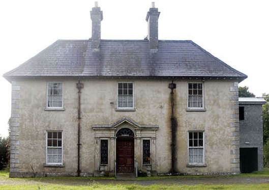 Castlecor Househunting/fishing lodge · 100 yd
 Moygh Househouse · 886 yd
 Cultivation ridges in CastlecoreCultivation ridges · 1154 yd
 Fulacht fia in Rathmore (shrule By.)Fulacht fia · 1494 yd
 European BeechEuropean Beech · 1.3 mi
 Bawn in TirlickeenBawn · 1.6 mi
 Noughaval CemeteryArchaeological place · 2.7 mi
 Corlea Bog Walk Canal BranchWalking route · 3.8 mi
 Corlea Trackway Interpretative CentreHeritage attraction · 4.0 mi
 Corlea Bog Walk Blue LoopWalking route · 4.3 mi
 Leveret IslandIslet · 4.4 mi