What is recorded here
Castle is an 18m ringwork in Moanmore parish, County Tipperary, where a 2.55m scarp and shallow fosse still mark a small defended chamber on an ESE-facing slope. Its western and eastern gaps suggest entry rather than endless mystery, while vegetation now swallows parts of the ridge. A person may have stood inside at dusk, listening for footsteps on the pasture beyond the ditch.
In pasture, on an ESE-facing slope. Circular area (diam. 18m) defined by scarp (Wth 5.3m; H 2.55m) which is obscured by vegetation WNW-NE and S-SW. Fosse (overall Wth 9m; basal Wth 1.9m; D 0.2m) WNW-NE and SE-SW and is obscured by vegetation S-SW. Interior has a gentle S-facing slope in N-half. Gap (Wth 3m) at W and at ESE (Wth 3.5m) where scarp is lower.
Compiled by: Jean Farrelly
Date of upload: 26 August 2011
The monument record does not grant public access. Check the route and ask the landowner before entering private land.
- What survives
- Recorded monument
Places near here
 Field system in Ballynagrana (emly Par.),moanmore (emly Par.)Field system · 508 yd
 Aughaclareen Bridgebridge · 1108 yd
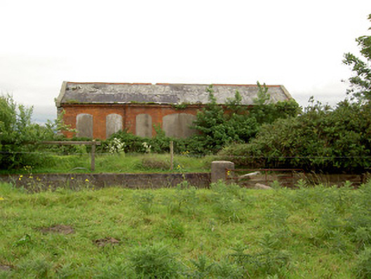 Emly Railway Stationstore/warehouse · 1222 yd
 Enclosure in LissobihaneEnclosure · 1458 yd
 Carn (site of)Cairn, burial cairn · 1.2 mi
 Glebe Ho.Castle, unclassified · 1.8 mi
 Ryves CastleCastle, unclassified · 2.6 mi
 Saint Patrick's WellSpring · 3.5 mi
 St Patrick's WellSpring · 3.6 mi
 Flat cemetery in Knockainy WestFlat cemetery · 5.7 mi
 Kilteely HillMountain / peak · 5.9 mi
 SlievereaghMountain / peak · 5.9 mi