What is recorded here
Hugh de Lacy granted the barony of Skreen to Adam de Feipo by c. 1172, and Adam probably made Skreen its caput or centre (Otway-Ruthven 1964). It is situated on a S-facing slope of the hill c. 300m S of the Columban church (ME032-047003-). This is a flat-topped earthen mound (diam. of top 15m; diam. of base 40m; H 6m) planted with deciduous trees. The castle (ME032-047002-) is c. 80m to the NNE.
From the National Monuments Service (Archaeological Survey of Ireland) record ME032-047001
The monument record does not grant public access. Check the route and ask the landowner before entering private land.
- What survives
- Recorded monument
Places near here
Photo credits
- Garry Dickinson, Geograph · CC BY-SA 2.0
- National Inventory of Architectural Heritage
- Patrick Brown, Wikimedia Commons · CC BY-SA 2.0
- Anthony Foster, Geograph · CC BY-SA 2.0
- Anthony Foster, Wikimedia Commons · CC BY-SA 2.0
- Neil Forrester, Co.Meath, Ireland. http://neil.forrester.ie, Wikimedia Commons · CC BY 3.0
- Verdasuno at English Wikipedia, Wikimedia Commons · CC BY-SA 3.0
- William Murphy, Wikimedia Commons · CC BY 2.0
- Kieran Campbell, Geograph · CC BY-SA 2.0
- Willow, Wikimedia Commons · CC BY 2.5
- Malene Thyssen, Wikimedia Commons · CC BY-SA 3.0
 Skreen CastleCastle, tower house · 111 yd
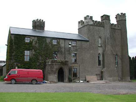 Skreen CastleCountry house · 119 yd
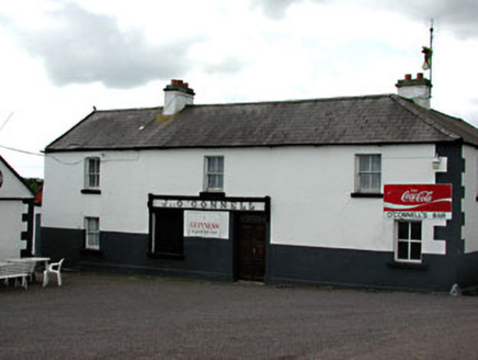 J. O'ConnellHouse · 458 yd
 Hill of TaraVisitor information · 2.0 mi
 Saint Patrick'sMemorial · 2.0 mi
 Dumha na nGiallArchaeological place · 2.0 mi
 Battle of Tara HillBattle · 2.1 mi
 Lia FailStanding stone (present location) · 2.1 mi
 Battle of Tara (Ireland)Major battlefield · 2.1 mi
 CastleCastle, tower house · 2.2 mi
 European ash2.9 mi
 European Beech3.9 mi
More castles and forts in County Meath · All of County Meath
What do you know about this place?