What is recorded here
Oval-shaped flat-topped mound (max H 3.50m, max W at top N-S c. 20m, 14mE-W, max basal dims N-S c. 31m, E-W c. 25m) situated in low lying area in N sector of graveyard and delimited by a wide shallow fosse. Steep sided at N and quarried at W side. Possible motte. Poorly preserved low square shaped motte (H 3.5m; top diam 14 - 20m; base diam 30m) located in the N sector of Annagharvey graveyard (OF018-017001-) enclosed by a wide flat bottomed fosse with no evidence of a bailey.
From the National Monuments Service (Archaeological Survey of Ireland) record OF018-017005
The monument record does not grant public access. Check the route and ask the landowner before entering private land.
- What survives
- Recorded monument
Places near here
Annagharvey Grave YardGraveyard · 13 ydLadys WellHoly well · 924 ydLady's WellSpring · 937 ydChildren's WellSpring · 993 yd farm house1627 ydfarm house1.4 miCastle in ruinsCastle, unclassified · 2.1 miFurzehill WoodWood · 2.1 miGeashill Glebe WalkVisitor information · 2.6 miFather BurbageMemorial · 2.6 miMick the MillerMemorial · 4.6 miGrand Canal WayWalking route · 4.6 mi
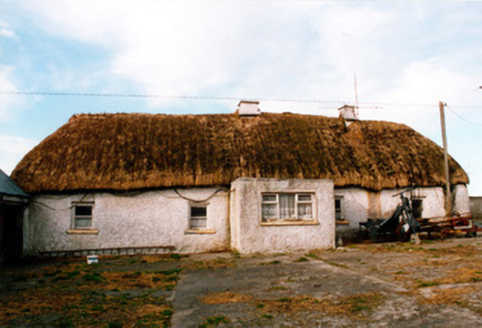 farm house1627 yd
 farm house1.4 miCastle in ruinsCastle, unclassified · 2.1 miFurzehill WoodWood · 2.1 miGeashill Glebe WalkVisitor information · 2.6 mi
 Father BurbageMemorial · 2.6 mi
 Mick the MillerMemorial · 4.6 mi
 Grand Canal WayWalking route · 4.6 mi
Pictures: National Inventory of Architectural Heritage; Trenchspike, Wikimedia Commons · CC BY-SA 4.0; kevin higgins, Wikimedia Commons · CC BY-SA 2.0; JP, Geograph · CC BY-SA 2.0
More castles and forts in County Offaly · All of County Offaly
What do you know about this place?