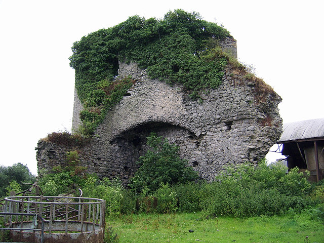
What is recorded here
Castle stood as a motte and bailey in Brittas, County Limerick, near the Mulkear River. O’Dwyer measured the disturbed earthen mound at 64m across and 6m high in 1964. The wooden tower on that mound may have given Brittas its name. Levelled pasture has taken the castle from sight, but the river and field still hold the shape of what stood there.
In pasture 150m W of Mulkear River that marks the townland boundary with Eyon, 100m SW of Brittas Castle (LI015-009----). No surface remains visible of levelled motte castle identified by O’Dwyer (1964, 95) who described the earthwork as ‘a large earthen mound now much disturbed, 210 feet [64m] in diameter and rising 20 feet [6m] above the level of the field. An apparently artificial cutting runs from this mound to the river about 450 feet [137m] distant. Not marked on the OS map. It is about 450 feet [137m] SW of Brittas Castle and appears to be an Anglo Norman motte; the bretasche (wooden tower) which originally crowned this mound is probably that which gave the townland its name’. No surface remains visible today on Digital Globe orthoimage 2011-2013.
See attached Google Earth orthoimages taken 28/06/2018 and 05/04/2006
Compiled by: Martin Fitzpatrick
Date upload: 6 July 2020
The monument record does not grant public access. Check the route and ask the landowner before entering private land.
- What survives
- Recorded monument
Places near here
 Castle (in ruins)Castle, Anglo-Norman masonry castle · 177 yd
 Brittas Bridgebridge · 317 yd
 Enclosure in BallyartEnclosure · 941 yd
 Enclosure in Castle-Erkin NorthEnclosure · 1046 yd
 Eyon Housecountry house · 1101 yd
 Bawn in RathBawn · 1.2 mi
 Graveyard in AbingtonGraveyard · 1.9 mi
 Sliev Felim WayVisitor information · 3.1 mi
 KnockseefinMountain / peak · 3.7 mi
 ToberagaddySpring · 4.6 mi
 Slieve Felim WayWalking route · 5.4 mi
 St. Patrick's WellSpring · 5.5 mi
Other information
Photo: Garry Dickinson · CC BY-SA 2.0