What is recorded here
From the National Monuments Service (Archaeological Survey of Ireland) record MA121-152
Places near here
Photo credits
- Maker not stated on source page, tr.pinterest.com
- Maker not stated on source page, www.skyscanner.ie
- National Inventory of Architectural Heritage
- Maker not stated on source page, www.joinmychurch.com
- Maker not stated on source page, www.dreamstime.com
- Maker not stated on source page, commons.wikimedia.org
- Maker not stated on source page, www.hot-dinners.com
- Kmcnamee, Wikimedia Commons · CC BY-SA 4.0
- Maker not stated on source page, readymap.irish
 Fairy fort / stone ringfort in CahernabrockFairy fort / stone ringfort · 1144 yd
Explorer Tom Cahernabrock's New Year's resolution is to just disappear completely because being seen is too much effort. It’s an…
 Mocorha Castle in ruinsCastle, tower house · 1281 yd
Explorer Tom Mocorha Castle thinks modern buildings are for people who can’t handle the beauty of a broken vaulted ceiling. Brian…
 water pump1657 yd
Explorer Tom Water pump in Cahermaculick is standing in a rural scene looking like it forgot its lines for the play. It’s a cow-tail…
 Church in MoorgagaghChurch · 1.1 mi
Explorer Tom Church in Moorgagagh is hiding a scandal involving a stolen chalice and a very angry goat that it hasn't told anyone…
 Mapped graveyardGraveyard · 1.1 mi
Explorer Tom The bishop refused to visit this Mapped graveyard in Mayo because he was afraid of the crows. He said they had bad…
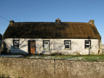 farm house1.5 mi
Explorer Tom Farm house in Brodullagh North, Mayo, is standing there with a feint battered silhouette that looks like it’s been…
 Earthwork in Brodullagh SouthEarthwork · 1.6 mi
Explorer Tom Earthwork in Brodullagh South would be the guest at the party who brings a giant wheel of cheese but forgets to bring a…
 Ballisnahyny Castle in ruinsCastle, unclassified · 1.7 mi
Explorer Tom Ballisnahyny Castle saw a very dramatic incident where a knight dropped his sword and couldn't pick it up because he…
 Man-made underground passage in BullaunMan-made underground passage · 1.9 mi
Explorer Tom Man-made underground passage in Bullaun is refusing to fall down like it’s got a personal grudge against gravity. It’s…
 Glencorrib/Kilroe Community Sports Field, Shrule-Glencorrib GAAGAA ground · 2.0 mi
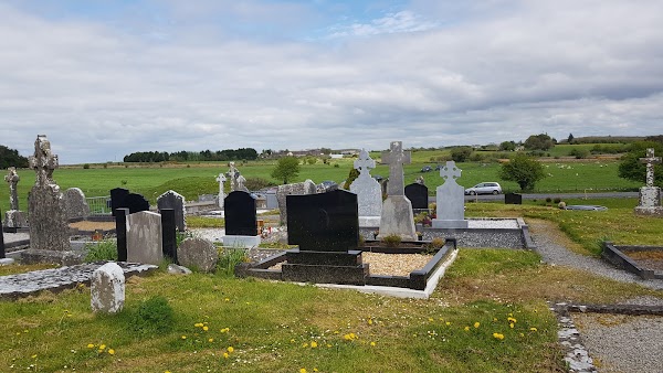 Mapped cemeteryCemetery · 5.2 mi
Explorer Tom This mapped cemetery was once targeted by a cow that tried to buy it with a single hoof print. The farmer laughed, but…
 InchiquinIsland · 6.4 mi
Explorer Tom Inchiquin would tell us its deepest secret after three pints: it’s actually a giant stone that fell asleep and forgot…
More castles and forts in County Mayo · All of County Mayo

What do you know about this place?Tap to add a comment or ask a question