DDiscover AloneMapAbout

Castle in Dunran Demesne

Castle, tower house
Castle in Dunran Demesne
Representative picture, exact place not confirmed
Photo: Maker not stated on source page, ca.pinterest.com · Report the wrong picture

The monument record does not grant public access. Check the route and ask the landowner before entering private land.

What do you know about this place?Tap to add a comment or ask a question

What you write will be public.

What is recorded here

16th century castle known as Kiltimon Castle that was modified and converted into a sham castle in the 18th century when a walled garden was constructed around the medieval fortification (Corlett 2008, 50). Situated on a gentle S/SE-facing slope standing inside an 18th century circular walled garden. Rectangular…

Read the whole record
16th century castle known as Kiltimon Castle that was modified and converted into a sham castle in the 18th century when a walled garden was constructed around the medieval fortification (Corlett 2008, 50). Situated on a gentle S/SE-facing slope standing inside an 18th century circular walled garden. Rectangular structure (ext. dims. 12.5m NW-SE; 8m SW-NE; int. dims. 8.8m NW-SE; 4.8m SW-NE) built of mortared uncoursed granite and slate rubble. The walls are 1.55-2m thick with a base-batter on the NE and SE sides. There are two doorways, at the centre of the SE wall and at the S end of the NE wall. On the ground floor there are three plain niches and two windows in double-splayed opes in the SW wall with one double-splayed window in the NW wall. A straight intramural stairs (uneven and formed of rubble) opens from beside the NE door and rises through the SE wall to a landing which opens through a flat lintelled doorway onto the first-floor level which has a window (in a splayed ope) and a large niche in the NW wall. There is an intramural chamber in the S angle at this level. At second-floor level there is a single off-centre window in the NW wall. There are round corner towers rising from the roof level and simple crenellations along the top of all four walls. Both low gables survive. There are no corbels for wall-plates and no other evidence for supporting the floors. There is no cut stone in the structure and the window and door opes are built of uncoursed rubble. Corlett (2008, 47-70) suggests that the structure is likely to be a medieval castle which subsequently was converted into a folly. Described in the Ordnance Survey Letters of 1838-40 (O’Flanagan 1928, 86) as ‘an old Castle in Dunran townland 29 feet [8.5m] long, 16 feet [4.8m] broad and about 36 feet [11m] high; the walls 6 feet 3 inches [1.9m] thick. It is completely gutted, but the shell remains without the loss of a single stone, parapet, warders tower and all. It has a door in the east end, 9 feet four inches [2.8m] high, of which its sharp pointed arch makes three; and three feet nine inches [1.14m] wide. It has 8 windows in the walls all round, some of them glazed; beside several loopholes. This castle was in full habitable order at the time that Lord Cornwallis was Viceroy of Ireland, and that nobleman attended a grand ball that was given in this castle by the proprietor, Mr. Grogan. The passage to the top is through eastern end, but after you ascend to the first story you find it closed against you. The windows that give light to this passage are square within, and sharp pointed outside’. In 1933 Price (1933, 236) recorded that ‘in 1641 one of the O'Byrnes was still the proprietor, but I am unable to say whether he belonged to the same branch of the family or not; on the Cromwellian Settlement it was granted to Sir John Borlace. The castle is shown on the Down Survey map of 1652 as, a square keep with what appear to be beehive shaped huts standing near it, no doubt portion of a village. The keep is shown as standing on the top of a small hill. The old castle now standing in Dunran Demesne is in much the same position as that shown on the map of 1652, but it is not on a hill, but half way down a slope; and a careful examination of the style of building shows, I think, that it is not an old building. When O'Curry saw and described it in 1839 there were window frames and glass in the windows: otherwise it is in exactly the same condition now as then. I think it is extremely likely that Gen. Cuninghame, afterwards Lord Rossmore, who seems to have laid out Dunran Demesne about 1770, built an "imitation antique" castle to ornament his demesne, either on the site of the ruin of the original castle, or perhaps a little distance away ; it may have been up on the hill on the other side of the road which bounded his demesne’. Journal of the Royal Society of Antiquaries of Ireland 138, 47-70.

From the National Monuments Service (Archaeological Survey of Ireland) record WI019-009

Places near here

Photo credits
  • Maker not stated on source page, uk.pinterest.com
  • Michael Dibb, Geograph · Creative Commons Attribution-ShareAlike 2.0
  • National Inventory of Architectural Heritage
  • Maker not stated on source page, commons.wikimedia.org
  • Maker not stated on source page, www.flickr.com
  • Maker not stated on source page, monumentalireland.ie
  • Simon Mortimer / Geograph Ireland, www.geograph.ie
CastleRuins · 4 yd

Explorer Tom Castle in County Wicklow is run by a matchmaker who only pairs people if they both like the view from the top window.…

Kiltimon CastleCastle/fortified house · 20 yd

Explorer Tom Kiltimon Castle in County Wicklow is the ultimate pretender, posing as a medieval ruin but acting like a fancy folly.…
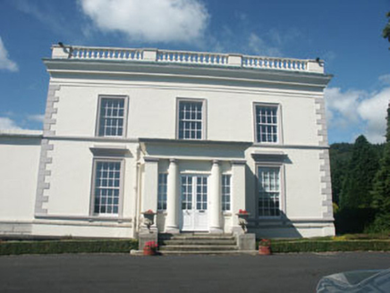
Dunran CastleCountry house · 292 yd

Explorer Tom Dunran Castle was nearly sold for a horse during a particularly bad market day in the 1850s. It assumed an Italianate…
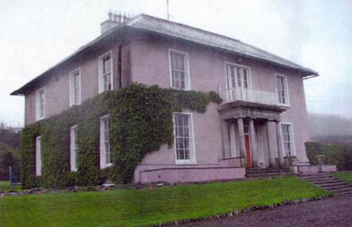
Kiltimon HouseCountry house · 456 yd

Explorer Tom Kiltimon House confused the map makers so much they gave up and just drew a big X nearby. It has a Doric portico in…

Standing stone in Moorstown (newcastle By.)Standing stone · 1145 yd

Explorer Tom Standing stone in Moorstown leans over the ridge like it’s checking its phone for messages. Map makers got it wrong, so…

Mount John HouseGate lodge · 1447 yd

Explorer Tom Mount John House was nearly sold as a horse because someone misread the listing and thought 'lodge' meant 'stable.'…

Bullaun stone in Ballyvolan LowerBullaun stone · 1503 yd

Explorer Tom Bullaun stone in Ballyvolan Lower would post a selfie with the caption 'just chilling upside down' if it had thumbs. It…

Enclosure in CourtfoyleEnclosure · 1571 yd

Explorer Tom Enclosure in Courtfoyle has an imaginary twin across the sea who is jealous of all this grassy attention. It’s a proper…

Fairy fort / ringfort in CullenmoreFairy fort / ringfort · 1640 yd

Explorer Tom Fairy fort / ringfort in Cullenmore would describe the 1800s to a teenager as 'a time when everyone was very loud about…

Fairy fort / ringfort in RathmoreFairy fort / ringfort · 1.5 mi

Explorer Tom Fairy fort / ringfort in Rathmore is deeply suspicious of the postman because he keeps dropping letters about its…

water pump1.7 mi

Explorer Tom Water pump in Blackditch hates visitors who bring their dogs because they always try to drink directly from the spout.…

Newtown GAAGAA ground · 1.8 mi

More castles and forts in County Wicklow · All of County Wicklow

Add to this placeAdd a picture Add a detailed tip Add a story

Explore the map1,095,414 places to discover

Next place · or swipeCastle