Places near here
Photo credits
- National Inventory of Architectural Heritage
- Oliver Dixon, Wikimedia Commons · CC BY-SA 2.0
- Mike Searle, Geograph · CC BY-SA 2.0
- Malene Thyssen, Wikimedia Commons · CC BY-SA 3.0
- Algirdas at Lithuanian Wikipedia, Wikimedia Commons · Public domain
- Richard Webb, Geograph · CC BY-SA 2.0
- Gillaween, Wikimedia Commons · CC BY-SA 4.0
- 2ManyCats4Me, Wikimedia Commons · CC0
- Kieran Campbell, Geograph · Creative Commons Attribution-ShareAlike 2.0
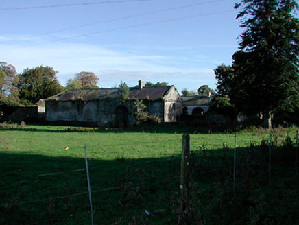 Donore HouseFarmyard complex · 1707 yd
Explorer Tom Donore House in Donore is playing musical chairs with its own history. The main house burned down, but the outbuildings stayed behind, still showing off their fancy limestone like it’s a big deal. I bet they’re humming 'Bohemian Rhapsody' to themselves because nobody else is listening.
 BallinacloonOutbuilding · 1.4 mi
Explorer Tom Ballinacloon is standing alone like a lonely uncle who lost his family in a property scandal around 1930. It’s definitely got some attitude, probably muttering about the big house that used to stand right next door. Say hello and ask if it wants to come for a drink, even if it can’t move!
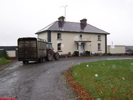 Soho HouseHouse · 1.4 mi
Explorer Tom Soho House in Cloondalin is playing hide-and-seek with me. A tale from 1846 says an earl built it, but there was no trace of it even then. Take a picture for me if you pass!
 Children of Lir: Lough DerravaraghLegend location · 1.7 mi
Explorer Tom Children of Lir: Lough Derravaragh starts with four children becoming swans because Aoife could not bear sharing the attention. That is not a family argument I want to referee. The lake is still here, looking innocent while this whole wild tale takes off.
 Carrick CastleCastle · 2.9 mi
Explorer Tom Carrick Castle is haunted by the memory of a fiddler who played all night until his fingers gave up, leaving behind nothing but the echo of a terrible jig. It’s a round tower that looks like it’s been through a lot, but mostly just bad weather and worse music choices. Go on a wet day, it suits the mood.
 European Beech3.8 mi
Explorer Tom European Beech in County Westmeath claims to hear everything through its walls, including your embarrassing phone calls and your questionable cooking attempts from last night. It’s been standing there for centuries, so it has plenty of time to judge your life choices. Ten minutes here and you'll have a yarn for the pub.
 Pedunculate Oak4.0 mi
Explorer Tom Pedunculate Oak in County Westmeath witnessed a love story that went badly wrong when one party dropped their ring into a hollow log and never looked back. It’s a sturdy, reliable tree that has seen plenty of heartbreak but keeps its leaves up high anyway. Go in good boots and better humour.
 CastleCastle, motte · 4.3 mi
Explorer Tom Castle in Russagh handles its nosey neighbours by simply not being there anymore, which is the ultimate passive-aggressive move. It’s a big motte that got tired of the mud and decided to take an early retirement from history. Take the long way round, it deserves the effort.
 Sheela-na-gig in AbbeylaraSheela-na-gig · 7.9 mi
 Granard MotteMotte-and-bailey castle remains · 9.3 mi
Explorer Tom Granard Motte would describe the 1800s to a teenager as 'basically a long queue for nothing'. It's just a big mound pretending it remembers something important from the castle days. Spot the oldest stone and give it a name.
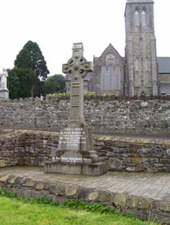 1798 MonumentMonument · 9.4 mi
 Fairy fort / earthen ringfort in ReynellaFairy fort / earthen ringfort · 11 mi
Explorer Tom Fairy fort / earthen ringfort in Reynella thinks the local sheep are just overgrown dogs that haven’t learned to bark yet. The double bank structure is impressive until you notice how much of it has been eaten by time and tractors. Linger, it's not going anywhere and neither should you.
More castles and forts in County Westmeath · All of County Westmeath

What do you know about this place?Tap to add a comment or ask a question