What is recorded here
On low-lying ground adjacent to the E shore of Lough Forbes. Depicted as a castellated tower on an early 17th-century map of Longford barony (BL, Cotton MS Augustus I.ii.24) and on the Down Survey (1655–6) map of Clongish parish (NLI, MS 719) as a low two-storey central block with gable-fronted towers at either end. A doorway at ground-floor level is centrally placed and there are two windows above it at first-floor level. One of the gable-fronted towers has windows on the ground and first-floor levels and is surmounted by a tall chimney stack which rises high above the roofline. Described in 1978 (SMR file) as a low irregular mound of stone and earth (c. 52m N–S; c. 24m E–W) that was delimited on the E by a low scarp; some stone, possibly wall-footing, was visible in its make-up from E–S. A disturbed subrectilinear area noted in the interior was open to the N and S but bounded on E and W by a broad irregular bank of stone and earth. It was covered with depressions and hummocks and although a fair amount of stone was visible on the surface it was not possible to trace any structures. Some large stones lying to the N appeared to have been dumped there. This may have been a medieval castle that was incorporated into a late 16th/early 17th-century house or it may date entirely from the later period. O'Donovan, Caimin O'Brien
Date of upload: 3 October 2012
On low-lying ground adjacent to the E shore of Lough Forbes. Depicted as a castellated tower on an early 17th-century map of Longford barony (BL, Cotton MS Augustus I.ii.24) and on the Down Survey (1655–6) map of Clongish parish (NLI, MS 719) as a low two-storey central block with gable-fronted towers at either end. A doorway at ground-floor level is centrally placed and there are two windows above it at…
From the National Monuments Service (Archaeological Survey of Ireland) record LF008-004
The monument record does not grant public access. Check the route and ask the landowner before entering private land.
- What survives
- Recorded monument
Places near here
 Castle ForbesChurch/chapel · 1084 yd
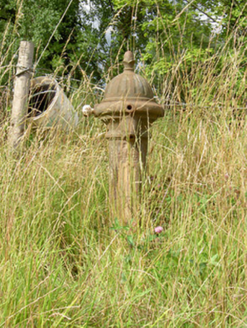 water pump1154 yd
 Castle ForbesWorker's house · 1282 yd
 Castle ForbesWalled garden · 1343 yd
 Castle ForbesGates/railings/walls · 1356 yd
.jpg/250px-Castle_Forbes,_Longford,_Co._Longford_(21680992271).jpg "Photo: Robert French, Wikimedia Commons · No restrictions") CastleforbesCastle · 1437 yd
CastleforbesCastle · 1437 yd Lebanon Cedar1452 ydLebanon Cedar1523 yd
 Grave YardGraveyard · 2.5 mi
 Saint Mel's CathedralCathedral · 4.5 mi
 First World War MemorialMemorial · 4.6 mi
 Rathcline CastleHouse, fortified house · 11 mi
Pictures: National Inventory of Architectural Heritage; Robert French, Wikimedia Commons · No restrictions; Olivier BEZES, Wikimedia Commons · CC BY 2.5; Davidcorry200, Wikimedia Commons · CC BY-SA 4.0; 瑞丽江的河水, Wikimedia Commons · CC BY-SA 4.0; Mike Searle, Geograph · CC BY-SA 2.0
More castles and forts in County Longford · All of County Longford
What do you know about this place?