What is recorded here
Situated at the N end of Baltinglass town close to Baltinglass Abbey. The 'abbot's castle' was demolished in 1882 to provide materials for the building of the rectory, which is adjacent to Baltinglass abbey (WI027-024001-). Foundations of the E end of the S wall are visible under the existing garden wall. A possible SE angle tower is indicated by the shape of the wall. It is of roughly coursed limestone, and the foundations are over 1m thick. Fitzgerald includes a print of a painting showing what appears to be a three- or four-storey tower house with windows with hood-mouldings, and a possibly later house built onto it. (Fitzgerald 1906-8, 397; Stalley 1987, 242)
The above description is derived from the published 'Archaeological Inventory of County Wicklow' (Dublin: Stationery Office, 1997).
Situated at the N end of Baltinglass town close to Baltinglass Abbey. The 'abbot's castle' was demolished in 1882 to provide materials for the building of the rectory, which is adjacent to Baltinglass abbey (WI027-024001-). Foundations of the E end of the S wall are visible under the existing garden wall. A possible SE angle tower is indicated by the shape of the wall. It is of roughly coursed limestone, and the…
From the National Monuments Service (Archaeological Survey of Ireland) record WI027-024002
The monument record does not grant public access. Check the route and ask the landowner before entering private land.
- What survives
- Recorded monument
Places near here
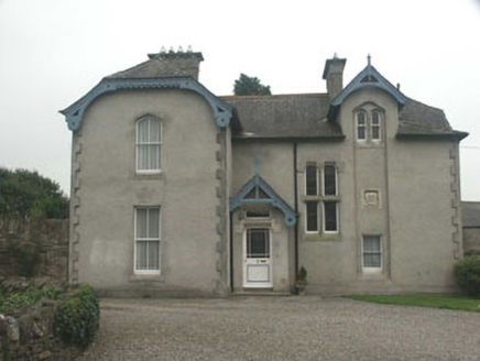 Saint Mary's Church (Baltinglass)Rectory/glebe/vicarage/curate's house · 15 yd
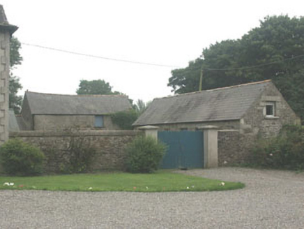 Saint Mary's Church (Baltinglass)Outbuilding · 36 yd
 Tinoran HillMountain / peak · 1.4 miSite of CastleCastle, unclassified · 1.5 miRahill Church (in ruins), GraveyardChurch · 2.3 miMoatamoyCastle, motte · 2.3 miSam McAllistair GraveMemorial · 3.3 mi
 European ash3.3 miSaint Brigit's Mass StoneNamed rock · 3.3 mi
 Rathvilly MoatArchaeological place · 4.5 mi
 European Beech4.6 mi
 Stone CrossCross, High cross · 5.4 mi
Pictures: National Inventory of Architectural Heritage; Sarah777, Geograph · CC BY-SA 2.0; Willow, Wikimedia Commons · CC BY 2.5; Wanfried-Dublin, Wikimedia Commons · CC BY-SA 4.0; Malene Thyssen, Wikimedia Commons · CC BY-SA 3.0; Andreas F. Borchert, Wikimedia Commons · CC BY-SA 4.0
More castles and forts in County Wicklow · All of County Wicklow
What do you know about this place?