
Places near here
Photo credits
- Fifiheavey, Wikimedia Commons · CC BY-SA 4.0
- National Inventory of Architectural Heritage
- Oliver Dixon, Geograph · Creative Commons Attribution-ShareAlike 2.0
- Grose, Francis, 1731?-1791; Ledwich, Edward, 1738-1823, continuator, Wikimedia Commons · Public domain
- Willow, Wikimedia Commons · CC BY 2.5
 Church (in Ruins)Church · 9 yd
Explorer Tom Church in Commons started a feud with the next village over who had the better stones. St Caillín turned druids into rocks, so technically he won the argument. Spot the oldest stone and give it a name to settle it.
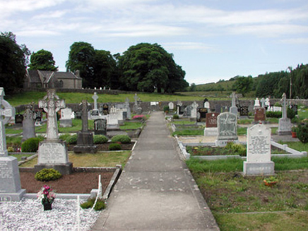 graveyard/cemetery19 yd
Explorer Tom The graveyard in Commons took exactly forty cups of tea to build, according to local legend. It sits on a hill with a ruined church watching over it like a grandpa. Stop the car, it's
 Graveyard20 ydBuck IslandIsland · 2.4 miCastleCastle, tower house · 2.5 miCrane IslandIslet · 2.6 miDrumbadMountain / peak · 3.9 mi
 IndicatedGraveyard · 4.3 mi
Explorer Tom Graveyard in Ardunsaghan means 'High Place of the Ghosts' or something equally terrifying, I think. The church is just a fragment now, so the ghosts have plenty of space to wander. Give it a pat on the way past, it's had a long life.
Cromlin Bridge WoodWood · 4.6 mi Castle JohnCastle · 4.7 mi
 European ash4.9 mi
Explorer Tom European Ash has a secret talent for looking impressive while doing absolutely nothing at all. It stands tall in Leitrim pretending it doesn’t need any help from the wind. Have a wander and a wonder.
Swan Island pet farmHeritage attraction · 5.1 miMore archaeology and monuments in County Leitrim · All of County Leitrim

What do you know about this place?Tap to add a comment or ask a question