What is recorded here
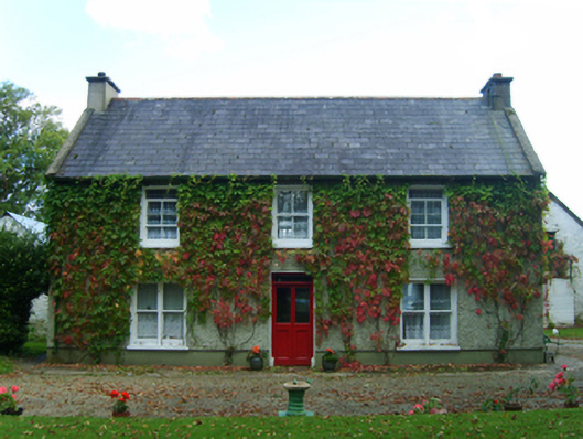
Detached three-bay two-storey farmhouse, built 1924, on a rectangular plan with three-bay two-storey rear (east) elevation. Pitched slate roof with terracotta ridge tiles, concrete coping to gables with rendered chimney stacks to apexes having concrete capping supporting terracotta pots, and cast-iron rainwater goods on roughcast eaves retaining cast-iron downpipes. Creeper- or ivy-covered roughcast walls bellcast over rendered plinth. Square-headed central door opening with concrete threshold, and concealed dressings framing glazed timber panelled double doors having overlight. Square-headed flanking window openings in bipartite arrangement with concrete sills, timber mullions, and concealed dressings framing one-over-one timber sash windows. Square-headed window openings (remainder) with concrete sills, and concealed dressings framing two-over-two timber sash windows. Set back from line of road in landscaped grounds with limewashed roughcast piers to perimeter having truncated pyramidal capping supporting flat iron double gates.
A farmhouse representing an integral component of the early twentieth-century domestic built heritage of County Wexford with the architectural value of the composition, one following the footprint of an earlier house (extant 1840) marked on the first edition of the Ordnance Survey (published 1841), suggested by such attributes as the compact rectilinear plan form centred on a restrained doorcase; and the diminishing in scale of the openings on each floor producing a graduated tiered visual effect with the principal "apartments" or reception rooms defined by bipartite glazing patterns. Having been well maintained, the elementary form and massing survive intact together with substantial quantities of the original fabric, thereby upholding the character or integrity of a farmhouse making a pleasing visual statement in a sylvan street scene.
From the Buildings of Ireland (National Inventory of Architectural Heritage) record 15704203
This does not grant access. Most recorded buildings are privately owned; view them only from public ground unless the owner allows entry.
Places near here
Photo credits
- National Inventory of Architectural Heritage
- Richard Webb, Geograph · CC BY-SA 2.0
- Simes69, Wikimedia Commons · CC BY-SA 4.0
- Maker named on the Wikimedia Commons picture page · CC BY-SA 3.0
- Walter Siegmund (talk), Wikimedia Commons · CC BY-SA 3.0
- David Hawgood, Wikimedia Commons · CC BY-SA 2.0
- Sheila1988, Wikimedia Commons · CC BY-SA 4.0
- Andreas F. Borchert, Wikimedia Commons · CC BY-SA 4.0
- Jonathan Thacker, Geograph · CC BY-SA 2.0
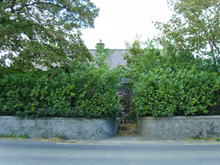 farm house438 ydCloraneMountain / peak · 1414 yd
 Forth MountainMountain / peak · 1598 yd
 SunriseFarm house · 1636 yd
 Monumental structure in Shelmaliere Commons (shelburne By., Carrick Ed)Monumental structure · 2.0 miBattle of Three RocksBattle · 2.0 mi
 Dawn Redwood2.2 mi
 Douglas-fir2.3 mi
 Johnstown CastleCastle · 2.3 mi
 Irish Agricultural MuseumMuseum · 2.4 mi
 Font in BallyconnickFont · 3.7 mi
 Taghmon CastleCastle · 4.2 mi
More historic places in County Wexford · All of County Wexford
What do you know about this place?