What is recorded here
Places near here
Photo credits
- Eric Jones, Geograph · CC BY-SA 2.0
- National Inventory of Architectural Heritage
 Enclosure in CarriveEnclosure · 566 yd
Explorer Tom Enclosure in Carrive hums with mystery right under the power lines, waiting for someone to ask what was happening here before wires.
 CroslieveMountain / peak · 736 yd
Explorer Tom This rocky knoll is an ancient volcanic vent reaching 360m, with stay wires for a blue light communications mast nearby.
 Mass Rock Loop TrailWalking route · 885 yd
Explorer Tom Loop around the Mass Rock Trail to find the Carrive Mass Rock shrine tucked behind the trees.
 Forkhill Greenspace PathwayWalking route · 1.0 mi
Explorer Tom Enjoy the Forkhill Greenspace Pathway, where a former army base has transformed into a peaceful woodland park.
Bawn in DungoolyBawn · 1.1 mi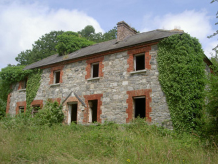 Dungooly MillMiller's house · 1.1 mi
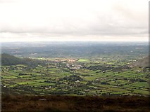 Ring of Gullion Way - ForkhillVisitor information · 1.2 mi
Explorer Tom At this Forkhill stop on the Ring of Gullion Way, you can see views extending well into the Republic. Breathtaking.
Enclosure in CarrickastickanEnclosure · 1.2 miExplorer Tom Enclosure in Carrickastickan might be hiding behind the old fold building, a quiet companion to the farming traditions of Armagh.
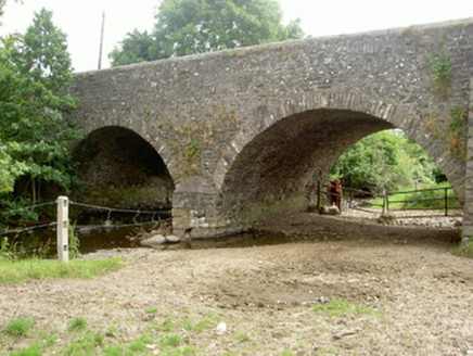 Dungooly BridgeBridge · 1.3 mi
 Mullaghbane MountainMountain / peak · 1.3 mi
Explorer Tom The Glendesha Road leads you right up to Mullaghbane Mountain, so let's follow it and see what this peak has in store.
 Ballsmill Amenity LandPicnic place · 1.5 mi
Explorer Tom Ballsmill Amenity Land sits right where Ballsmill Road meets Glasdrumman Road, perfect for a riverside picnic and a chat.
Golf 30Fort · 2.1 miExplorer Tom Golf 30 is actually a historic observation tower, not a golf course, standing proudly to watch over the rolling hills of County Armagh with a keen eye.
More walking routes in County Armagh · All of County Armagh
What do you know about this place?Tap to add a comment or ask a question