Places near here
Photo credits
- National Inventory of Architectural Heritage
- Mike Searle, Geograph · CC BY-SA 2.0
- Algirdas at Lithuanian Wikipedia, Wikimedia Commons · Public domain
- kevin higgins, Geograph · CC BY-SA 2.0
- Chmee2, Wikimedia Commons · CC BY-SA 3.0
- Colin Park, Geograph · CC BY-SA 2.0
- Humphrey Bolton, Geograph · Creative Commons Attribution-ShareAlike 2.0
Explorer Tom Fairy fort or ringfort in Glen Upper smells like wet wool and centuries of regret if you lean in close enough to check properly. It’s been invisible for years, so it’s probably feeling a bit self-conscious about its lack of presence lately. Ring your granny and tell her where you are.
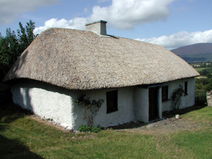 farm house1343 yd
Explorer Tom The farm house in Glen Lower is built perpendicular to the road because someone had a bad idea about windbreaks and fieldstones. It’s got a thatched roof that looks like it needs a serious haircut, and the whole thing sits there looking confused. Take the long way around if you don’t want to trip over its weird angles.
 Ballyclohy Castle (in ruins)Castle, tower house · 1588 yd
Explorer Tom Ballyclohy Castle thinks Dublin tourists are all talk and no walk, which is annoyingly true. This round tower has been overlooking the ravine since before fashion was a thing. Bring the dog, it'll have opinions.
 Pedunculate Oak1.2 mi
Explorer Tom Pedunculate Oak in County Waterford was skipped by the bishop because he couldn’t find his reading glasses and didn’t want to admit it. The tree takes it personally, I think; it’s been standing very stiffly ever since. Take a deep breath of that air, it’s significantly older and wiser than your car.
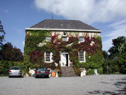 Landscape HouseHouse · 1.2 mi
Explorer Tom Landscape House in Landscape County Waterford thinks the local sheep are judging its architectural elegance and it wants to settle this debate with a formal letter. It overlooks the River Suir with an air of supreme importance, despite being just a very nice Georgian house. Whisper your opinion to the river.
 Castle (in ruins)Castle, tower house · 1.4 mi
Explorer Tom Poulakerry Castle is having a massive feud with the next village over something involving a cow or a deed, I’m not sure which. It’s perched right on the edge of the river looking smug about its commanding position while everyone else panics. Look up, the best bit is always higher than you think.
Maurice DavinMemorial · 1.9 miExplorer Tom Maurice Davin Memorial is where the town’s most notorious matchmaker used to work her magic. She paired so many couples that now everyone knows everyone else’s business here. It's the kind of place that makes a dull Tuesday interesting.
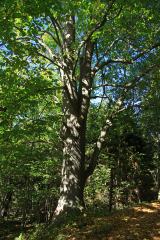 Large-leaved Lime2.0 mi
Explorer Tom Large-leaved Lime in County Waterford is doing a serious bit on the tree app, rating every visitor for their shoe choice and posture. It’s been giving five-star reviews to gulls and one star to anyone wearing flip-flops. I’m planning its housewarming party right now; bring your own leaves for decoration.
 KnocksheegownaMountain / peak · 3.5 mi
Explorer Tom Knocksheegowna has a curse that only affects people who don't wave when they pass by. You have to be polite or you'll trip over roots for a week afterwards. It's very particular about manners and etiquette up there. If it rains, blame me.
Curraheen TrailsVisitor information · 3.7 miExplorer Tom Curraheen Trails has a secret talent for making you feel like you're in a nature documentary when you’re just walking to the bus stop. It’s Trailhead 141, which sounds like a spy code but is actually just a dirt path with some ambition. If you walk fast enough, you might catch up to your own shadow and apologize. Pretend it's yours and plan the housewarming.
 Grave YardGraveyard · 3.9 mi
Explorer Tom Graveyard in Kilcash is on a slope with a tower house watching over it like a nosy neighbor. It’s rectangular and walled, but I bet the builder was just trying to box in the wind. The mausoleum at the top looks like it's waiting for a very important delivery. Tell it a joke, it's been a long time since anyone did.
 KnockanaffrinMountain / peak · 4.0 mi
Explorer Tom Knockanaffrin refuses to fall down because it knows gravity is a suggestion, not a rule. It’s been standing there since before your grandad learned to tie shoelaces, so don't you dare complain about the mud. Visit, then text me what you think. I'll pretend to read it.
More mountains and hills in County Waterford · All of County Waterford

What do you know about this place?Tap to add a comment or ask a question