
What is recorded here
From the National Monuments Service (Archaeological Survey of Ireland) record CL016-076
Places near here
Photo credits
- Maker not stated on source page, commons.wikimedia.org
- Maker not stated on source page, en.wikipedia.org
- The Banner, Wikimedia Commons · CC BY-SA 4.0
- Maker not stated on source page, ca.pinterest.com
- Maker not stated on source page, www.pinterest.com
- National Inventory of Architectural Heritage
- Gordon Hatton, Geograph · CC BY-SA 2.0
- Charles W Glynn, Geograph · CC BY-SA 2.0
- Golfing in Ireland; photographer not stated, Source publisher
- Kmcnamee, Wikimedia Commons · CC BY-SA 4.0
- N Chadwick, Wikimedia Commons
 Fairy fort / earthen ringfort in Ballagh (corcomroe By.)Fairy fort / earthen ringfort · 1096 yd
Explorer Tom Fairy fort / earthen ringfort in Ballagh is hiding in the trees like a shy elf. It’s got two banks and a ditch, but the…
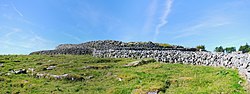 Fairy fort / earthen ringfort in BallynacarhaghFairy fort / earthen ringfort · 1616 yd
Explorer Tom Fairy fort / earthen ringfort in Ballynagun West is basically a muddy circle with a steep side, probably used for…
 Saint Attracta's Catholic ChurchChurch/chapel · 1.1 mi
Explorer Tom Saint Attracta's Church is a double-height building that probably echoes your every whisper back at you with judgment.…
 Cullagh CastleRuins · 1.1 mi
Explorer Tom Cullagh Castle took approximately four million cups of tea to build, or at least that's what the legend goes. It’s a…
 Island HillMountain / peak · 1.5 mi
Explorer Tom Island Hill in County Clare smells like wet wool and regret, according to Tom's very scientific assessment. It is…
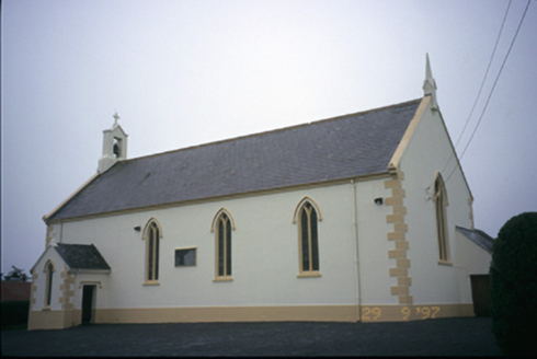 Saint Columba's Catholic ChurchChurch/chapel · 2.7 mi
Explorer Tom Saint Columba's Catholic Church in Teerleheen is pretending it’s ancient, but let's be honest, it’s just a posh 1846…
 Smithstown Castle (in ruins)Castle, tower house · 4.4 mi
Explorer Tom Smithstown Castle on a rocky outcrop is officially gone, but I swear it’s just napping. It thinks Dublin tourists are…
 Ennistymon Old CemeteryGraveyard · 4.4 mi
Explorer Tom Ennistymon Old Cemetery in County Clare would be the uncle at a wedding who gives a really long speech nobody asked for…
 George's HeadHeadland · 27 mi
Explorer Tom George's Head loves 'Bohemian Rhapsody' because it likes to think its dramatic cliffs are actually a very intense opera…
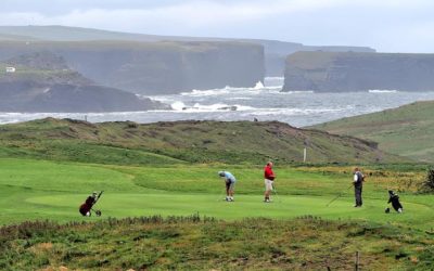 Kilkee Golf ClubGolf course · 27 mi
 St. Sennan's, Kilkee GAA pitchGAA ground · 27 mi
 Kilkee BeachBeach · 27 mi
Explorer Tom Kilkee Beach curves around a bay as if the town ordered a sandy armchair. Fáilte Ireland calls Kilkee a seaside stop…
More archaeology and monuments in County Clare · All of County Clare

What do you know about this place?Tap to add a comment or ask a question