Places near here
Photo credits
- Stan Courtney, Geograph · CC BY-SA 2.0
- National Inventory of Architectural Heritage
- Kenneth Allen, Geograph · CC BY-SA 2.0
- Malene Thyssen, Wikimedia Commons · CC BY-SA 3.0
- Andreas F. Borchert, Wikimedia Commons · CC BY-SA 4.0
- Simonchadwick1023, Wikimedia Commons · CC BY-SA 4.0
 Carn WoodForest · 833 yd
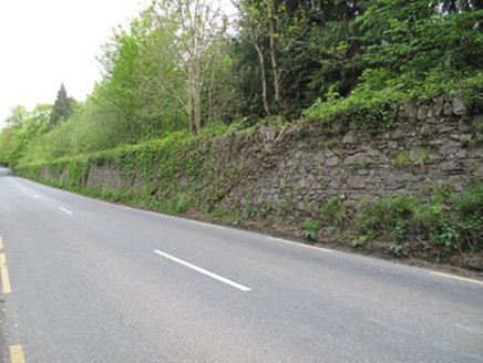 Hilton ParkDemesne walls/gates/railings · 1298 yd
Explorer Tom Hilton Park walls are random rubble, which is basically fancy rocks stacked with attitude. They think tourists from Dublin only come here to take selfies and drink overpriced coffee in the car park. Mind the nettles, they’re probably judging your footwear as you walk past them.
 Old Church (in Ruins)Church · 1.1 mi
Explorer Tom Old Church in Drumswords was the centre of a massive parish argument that ended in a draw. It sits on a slope like a grumpy old man refusing to move. Bring a flask, take a seat on the wall, and act like you own the whole estate.
 European Beech1.3 mi
Explorer Tom Another European Beech here remembers the day a goat tried to climb it and failed spectacularly. The whole valley saw the disaster unfold. Tell it a joke, it's been a long time since anyone did.
LattacrossanMountain / peak · 1.8 miCallowhillMountain / peak · 2.7 mi Ulster Canal Stores Visitor CentreHeritage attraction · 3.4 mi
 Shrine in CrossmoyleShrine · 3.5 mi
Explorer Tom Shrine in Crossmoyle would post 'Just woke up from a thousand-year nap' on social media. It looks like a tiny wooden church carved from sandstone. Bring a jacket, it's never as warm as I promise.
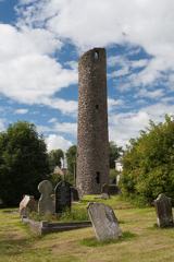 Round Tower3.5 mi
 Abbey RuinsHeritage attraction · 3.5 miSaint John's WellSpring · 3.7 miDrumcarn HouseCastle, unclassified · 4.4 mi
Explorer Tom Drumcarn House in Drumcarn does the cha-cha when nobody’s looking, just to keep its foundations flexible and young. It’s hidden under a farmyard, acting all mysterious like it knows something you don’t. If it rains, blame me.
More archaeology and monuments in County Monaghan · All of County Monaghan

What do you know about this place?Tap to add a comment or ask a question