DDiscover AloneMapAbout

Carnconnaughtagh

Cairn, unclassified
Computer-made picture that does not show CarnconnaughtaghNot a photo of this monument
Computer-made picture. It does not show this monument. · Report the wrong picture

What is recorded here

In low-lying marshy pasture c. 40m S of the Derreen River, within a bend in the river with wet ground to the S, and overlooked by higher ground to the N. The summit offers a commanding view down the river valley to the W and S. Indicated and named ‘Carnaconnaughtagh’ on the 1840 OS 6-inch map while named…

Read the whole record
In low-lying marshy pasture c. 40m S of the Derreen River, within a bend in the river with wet ground to the S, and overlooked by higher ground to the N. The summit offers a commanding view down the river valley to the W and S. Indicated and named ‘Carnaconnaughtagh’ on the 1840 OS 6-inch map while named ‘Carnconnaughtaun’ on the 1916 ed. Described by O’Donovan in 1839 (Comber 1997, 98-9) as ‘measuring one hundred paces in circumference, tapering to the top, and about twenty-five feet in height’. Westropp (1905, 361) estimated its height as ‘12 feet to 14 feet high’. Commenting on its name O’Donovan (Comber 1997, 98-9) reported that ‘the tradition in the neighbourhood is that a multitude of Connachtmen on one occasion followed a large serpent from their own country to this place, where they succeeded in killing it, and each having carried a stone in his hand in the pursuit, they all threw them into one heap here on the death of their prey, and hence the name’. O’Donovan (1854, vol. V, 1669-1670) identified the site as the historical Carn Mhic Táil, suggesting that it was ‘probably the place where the Chief of Corcomroe was inaugurated before Burren was separated from Coromroe’. As FitzPatrick has argued (1997, 18), while there are no specific historical references to inauguration at the site, it is mentioned as a meeting and mustering place for battles, which combined with its putative ancestral links to the Corcu Modruad, via its namesake Táil, make a case for its role as an inauguration site. She further suggests that that it may have assumed a role as an inauguration site in the first half of the eighth century following the expulsion of the Corcu Modruad from much of south and east Clare by the Dál gCais, with Carn Mhic Táil assuming a new significance as a landmark and inauguration site on the southern boundary of their reduced kingdom. A steep-sided circular stone cairn (diam. 24.5m; H 6.6m) with a slightly convex summit (diam. 12m) composed of large angular pieces of limestone rubble. Robbed out at W and S. To E, a low stone revetment (L 8m; H 0.4m) can be seen within the rubble. At N, E, and S low (H 1.5m; T 1m) drystone walls extend c. 13m from the cairn, possibly built from loose collapsed material to serve as animal shelters. Cultivation ridges are clearly visible on ortho photography (MapGenie 2013) in the field surrounding the monument. 1997 The historic assembly sites of Tulach Uí Dheadhaidh and Carn Mhic Táil. The Other Clare 21, 17-19.

From the National Monuments Service (Archaeological Survey of Ireland) record CL015-018

The monument record does not grant public access. Check the route and ask the landowner before entering private land.

What do you know about this place?Tap to add a comment or ask a question

What you write will be public.

Places near here

Photo credits
  • National Inventory of Architectural Heritage
  • Gordon Hatton, Geograph · CC BY-SA 2.0
  • Joseph Mischyshyn, Geograph · CC BY-SA 2.0
  • Bob Jones, Wikimedia Commons · CC BY-SA 2.0
  • Kmcnamee, Wikimedia Commons · CC BY-SA 4.0
  • nick macneill, Geograph · CC BY-SA 2.0
  • N Chadwick, Wikimedia Commons · CC BY-SA 2.0
  • N Chadwick, Geograph · Creative Commons Attribution-ShareAlike 2.0
  • Colin Park, Geograph · CC BY-SA 2.0
  • NateBergin, Wikimedia Commons · CC BY 4.0
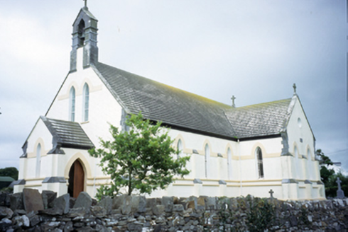
Saint Augustine's Catholic ChurchChurch/chapel · 1041 yd

Explorer Tom Saint Augustine's Church has lancet windows that look like they’re trying to slice through the sky. Built in 1893, it’s…
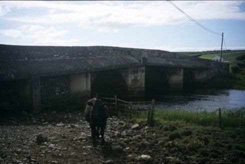
New BridgeBridge · 1.6 mi

Explorer Tom New Bridge in Ballingaddy West thinks it's the cool cousin because it has three arches instead of one. Its fan club…

Smithstown Castle (in ruins)Castle, tower house · 1.9 mi

Explorer Tom Smithstown Castle on a rocky outcrop is officially gone, but I swear it’s just napping. It thinks Dublin tourists are…

Famine MemorialMemorial · 2.4 mi

Explorer Tom The Famine Memorial acts like it’s the guest at a wedding who stole the cake, standing there with its arms crossed in…

Dough CastleRuins · 2.6 mi

Explorer Tom Dough Castle has a name that sounds ready for baking, but its first job was watching traffic by the Inagh estuary. The…

Ennistymon GAA pitchGAA ground · 2.6 miLahinch BeachBeach / strand · 3.3 mi

Explorer Tom Lahinch Beach has the rabbits running rings around it, probably plotting to take over the dunes and start their own…

Kilfenora GAA pitchGAA ground · 3.3 miHigh CrossVisitor attraction · 3.7 mi

Explorer Tom High Cross was once offered for sale by a very confused cow who thought she could buy it with a bag of coins. She paid…

Graveyard3.8 mi

Explorer Tom Graveyard in Kilfenora wraps around the cathedral with a rubble wall. There's a fairy dispute over parking rights at…

Burren Centre KilfenoraVisitor information · 3.8 mi

Explorer Tom The Burren Centre in Kilfenora is a sensible first stop before trying to make sense of north Clare's limestone hills. I…

Cathedral (in ruins)Cathedral · 3.8 mi

Explorer Tom Kilfenora Cathedral is having a bit of a feud with the next village over something daft like whose sheep ate whose…

More archaeology and monuments in County Clare · All of County Clare

Add to this placeAdd a picture Add a detailed tip Add a story

Explore the map1,095,052 places to discover

Next place · or swipeSaint Augustine's Catholic Church