
Places near here
Photo credits
- National Inventory of Architectural Heritage
- Willow, Wikimedia Commons · CC BY 2.5
- GTD Aquitaine, Wikimedia Commons · Public domain
- Djedi Guy, Wikimedia Commons · CC BY-SA 4.0
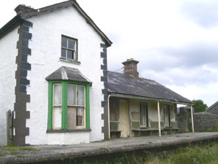 Leyny Railway StationRailway station · 719 yd
Explorer Tom Leyny Railway Station is now disused but still thinks it’s the coolest place in Coolaney, probably because it used to be busy with trains and important people back then. There was a massive feud with the next village over who had the best ticket office layout, which is such a daft thing to argue about.
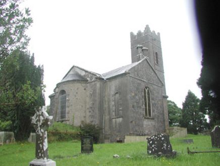 Killoran ChurchChurch/chapel · 1110 yd
Explorer Tom Killoran Church in Rathbarran has a long grudge against the weather because it keeps trying to wash away its splayed corners and semi-circular chancel. It’s sitting there with its basement crypt and stained glass, looking like it’s ready to argue about who designed the apse better. Tell it you love the random rubble masonry.
Enclosure in CarrownacarrickEnclosure · 1268 ydExplorer Tom Enclosure in Carrownacarrick: There’s a ghost here who’s too lazy to haunt the place; he just lies down in the middle and naps through the whole spooky bit. You can’t even see it from the ground, so imagine how confused the spirit must be looking for its own house. Bring someone who'll believe anything.
Mass RockMass-rock · 1292 ydExplorer Tom Mass Rock in Rathbarran sits in a ditch like it’s hiding from its own reputation, which is actually quite fitting. The map makers got it wrong because they were drunk, or lazy, probably both, so don't quote them. Look serious, nod slowly, you're basically an expert now.
IndicatedCastle, motte · 1316 ydExplorer Tom Castle in Rathosey hears everything through its thick walls, including your thoughts about how hungry you are. It’s a motte by the river that looks like it’s trying to float away. Bring biscuits, every good story needs biscuits.
Moymlough Castle (in Ruins)Castle, tower house · 1.5 miExplorer Tom Moymlough Castle would describe the 1800s to a teenager as 'vibes were off but the stone was solid.' It’s missing half its walls, so it’s basically a skeleton with attitude problems. Take a breath of that air, it's older than your car.
Tullaghan HillMountain / peak · 1.6 miExplorer Tom Tullaghan Hill in County Sligo nearly became famous for hosting a very bad karaoke night in the eighties. It’s still trying to shake off the embarrassment. Stand there long enough and someone will ask if you're lost.
 European ash3.1 mi
Explorer Tom European ash in County Sligo started because two lads bet that if it survived a storm, one had to buy drinks for a year. The tree won, and the bar tab is still technically open. Bring a flask of something warm and a story to swap.
 Elder3.7 mi
Explorer Tom Elder in County Sligo is haunted by a ghost who is far too lazy to even cross the road. He just sits on a branch judging everyone's life choices from above. Stand where the owner stood and practise looking smug.
 Battlefield in Carricknagat (leyny By.),rinn (leyny By.),bleachgreen,collooney,ardcottenBattlefield · 4.7 mi
Explorer Tom Battlefield in Carricknagat survived a massive storm by just staying put, which is impressive for a spot with such a chaotic history of conflict and confusion. It’s got a real 'I’ve seen it all' attitude that makes you feel like your problems are tiny in comparison to the old wars. Go at sunset and thank me later.
 Teeling MonumentMemorial · 4.7 mi
Explorer Tom The Teeling Monument refuses to fall down because it’s too proud to admit the ground beneath it is just soft mud. It stands there looking smug, like it owns the whole of Collooney and knows secrets it won’t share. Give it a pat on the way past, it's had a long life.
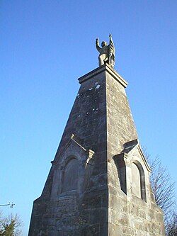 Battle of CollooneyBattle · 4.7 mi
Explorer Tom The Battle of Collooney in County Sligo took about four cups of tea to build up the energy needed for the fighting, and they used them all up. Bartholomew Teeling put up a monument there, which is basically a giant finger wagged at history for forgetting this little scuffle. Stop the car, it's worth the hazard lights.
More archaeology and monuments in County Sligo · All of County Sligo

What do you know about this place?Tap to add a comment or ask a question