
Places near here
Photo credits
- Andreas F. Borchert, Wikimedia Commons · CC BY-SA 4.0
- Jtonra, Wikimedia Commons · CC BY-SA 4.0
- National Inventory of Architectural Heritage
- P L Chadwick, Wikimedia Commons · CC BY-SA 2.0
- Keith Salvesen, Wikimedia Commons · CC BY-SA 2.0
- Martin Kerans, Geograph · CC BY-SA 2.0
- Joseph Mischyshyn, Wikimedia Commons · CC BY-SA 2.0
- Adrian King, Geograph · CC BY-SA 2.0
- Bob Jones, Geograph · CC BY-SA 2.0
- Roger Diel, Geograph · CC BY-SA 2.0
- Joseph Mischyshyn, Geograph · CC BY-SA 2.0
 CarnWedge tomb · 629 yd
Explorer Tom Carn in Parknabinnia is doing its best impression of a rock pile but it’s actually a wedge tomb that gave up its stone for Lent to lose weight. It sits on limestone pavement like a grumpy old uncle refusing to move. Go with someone who loves old stuff and watch them melt.
 Dermot and Granias BedWedge tomb · 1.1 mi
Explorer Tom The bishop refused to visit Dermot and Granias Bed because he thought it was too much like a bed and not enough like a tomb. It’s a well-preserved wedge tomb in the middle of a cashel, looking very comfortable with its intact capstone. Pop by and tell it it's looking well.
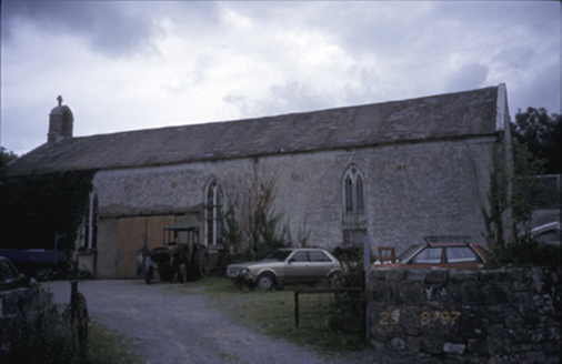 Saint Joseph's Catholic ChurchChurch/chapel · 1.4 mi
Explorer Tom Saint Joseph's Catholic Church in Killinaboy is now an outbuilding, which means its New Year’s resolution was to stop being holy and start storing things. It’s got a square-headed opening from 1975 that looks like a yawn. Spot the oldest stone and give it a name like 'Grumpy'.
 Killinaboy Round TowerVisitor attraction · 1.5 mi
Explorer Tom Killinaboy Round Tower and the nearest tree are in a fierce rivalry over who stands taller, even though the tree has had a head start by about two hundred years. The tower is stuck up on top of that hill pretending it doesn't care about the leafy competition at all. Bring your nan, she'll know more than me.
 Sheela na GigPublic artwork · 1.5 mi
Explorer Tom Sheela na Gig in County Clare is showing off her behind to every single passerby with zero shame or apology. She says she’s just keeping the evil spirits away with pure confidence. Make a wish, it's had centuries of practice.
 Kilinaboy Church (in ruins)Church · 1.5 mi
Explorer Tom Kilinaboy Church holds a fake world record for being the most photogenic ruin in County Clare, according to its own PR team. It was founded by Iníon Baoith, so it's got serious saint-cred going on. Great spot to propose. Or at least to propose lunch before you do.
 Leamaneh Castle (in ruins)Castle, tower house · 2.1 mi
Explorer Tom Leamaneh Castle in Leamaneh North is showing off its five-storey ego again, thinking it’s too good for the locals. It needs a better agent before it ends up in a tourist brochure, so get a photo with it first.
 Leamaneh CastleCastle · 2.1 mi
Explorer Tom Leamaneh Castle looks like two centuries got into a row and decided to share one wall. A late-fifteenth-century tower house stands beside a seventeenth-century mansion, built for Máire Rua MacMahon and Conor O'Brien after their marriage in 1639. The crossroads nearby once joined three Burren baronies, so this was no tucked-away country whim. Máire Rua has acquired a thicket of legends; I could add one more before breakfast, but her documented building work is odd enough. Even the name may mean a horse's leap or a deer's leap, depending on whom you ask. The ruin is on private land, so admire it from a lawful roadside position and do not cross a gate for a closer look. From there, compare the narrow old tower with its broader neighbour. Someone wanted both defence and comfort, and I suspect comfort finally won the argument.
 Inchiquin IslandIslet · 2.7 mi
Explorer Tom Inchiquin Island was built on a bargain where someone traded a secret recipe for a chunk of land in Lough Inchiquin. Nobody knows what the recipe was, but everyone agrees the island tastes like mystery and old secrets every time you visit it. Ideal spot for a dramatic phone call.
 Rock IslandIsland · 2.7 mi
Explorer Tom Rock Island is having a bit of a mood today, refusing to be the best man at its own wedding. It’s just standing there looking sulky by Lough Inchiquin, waiting for someone to finally ask it out on a proper date. Pop by and tell it it's looking well.
 Cave of the Wild HorsesCave · 4.4 mi
Explorer Tom Cave of the Wild Horses near Carran has an imaginary twin across the sea that never stops complaining about the weather. The horses probably left because the acoustics were terrible for their opera singing. Take the long way round, it deserves the effort.
 Poulnabrone - Burren GeositeVisitor information · 4.4 mi
Explorer Tom Poulnabrone is famous for being saved by a hero nobody remembers who just happened to be passing by with a really strong umbrella and good luck on his side during a particularly bad storm. He didn't even write a book about it or get a statue erected, he just walked away and went home for tea, leaving the dolmen to take all the credit for its survival over the centuries that followed after
More archaeology and monuments in County Clare · All of County Clare

What do you know about this place?Tap to add a comment or ask a question