
What is recorded here
Discovered at the E end of Killarah cairn (CV014-043002-). Investigated by Ó Ríordáin (1933, 167-71) in 1932. The grave comprised a limestone slab c. 2.14m x 1.21m 'which rested in a sloping position on a stone placed beneath it. The front or eastern end of the grave was closed by a low, roughly built, dry-stone wall…
Read the whole record
From the National Monuments Service (Archaeological Survey of Ireland) record CV014-043002
Places near here
Photo credits
- Maker not stated on source page, www.alamy.com
- Maker not stated on source page, ms.fusedlearning.com
- Kenneth Allen, Geograph · CC BY-SA 2.0
- Maker not stated on source page, commons.wikimedia.org
- Maker not stated on source page, uk.pinterest.com
- National Inventory of Architectural Heritage
- Dylan Moore, Geograph · Creative Commons Attribution-ShareAlike 2.0
- Maker not stated on source page, tr.pinterest.com
- Maker not stated on source page, www.pinterest.de
- Maker not stated on source page, www.pinterest.com
- Maker not stated on source page, www.gettyimages.ca
 Fairy fort / earthen ringfort in Cormeen (tullyhunco By.)Fairy fort / earthen ringfort · 841 yd
Explorer Tom Fairy fort / earthen ringfort in Cormeen got flattened when they diverted a stream in 1847. The dog that's in charge of…
 Fairy fort / earthen ringfort in AgharaskillyFairy fort / earthen ringfort · 1174 yd
Explorer Tom Agharaskilly is sitting on the riverbank and looks like it’s slowly melting into the mud. It’s got an overgrown bank…
 outbuilding1.4 mi
Explorer Tom Outbuilding in Mullaghmore would complain to the council about being left alone next to a farmhouse that no longer…
 Graveyard in MullynagolmanGraveyard · 1.4 mi
Explorer Tom Graveyard in Mullynagolman in Cavan is so quiet it could win a county fair for best 'who moved my hat' performance. The…
 Standing stone (present location) in ToberlyanStanding stone (present location) · 1.5 mi
Explorer Tom Standing stone in Toberlyan would post a picture of itself with the caption 'living my best rock life' and tag three…
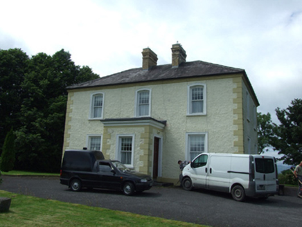 The PresbyteryPresbytery/parochial/curate's house · 1.5 mi
Explorer Tom The Presbytery in Kilnavert is a sober classical box for priests who needed somewhere to hide from their parishioners.…
 Saint Patrick's Catholic ChurchChurch/chapel · 1.6 mi
Explorer Tom Saint Patrick's Catholic Church in Kilnavert was designed by William Hague, who clearly liked showing off his skills.…
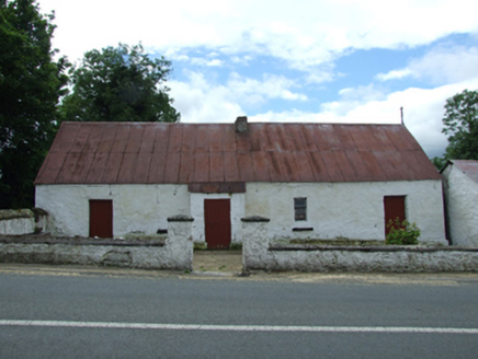 farm house1.6 mi
Explorer Tom Farm house in Kilnavert is a traditional thatched hearth-lobby plan with an outhouse under the same roof, which means…
 Standing stone in KilnavertStanding stone · 1.8 mi
Explorer Tom Standing stone in Kilnavert has a hole on top that used to hold wine during Penal times, which is wild. It's basically…
 Derrymony ForestForest · 5.0 mi
Explorer Tom Derrymony Forest claims to hold the Guinness World Record for having the most awkward silences between its trees, which…
 Moherloob ForestForest · 5.6 mi
Explorer Tom Moherloob Forest in County Cavan refuses to fall down because it thinks gravity is just a suggestion made by people who…
 Saint Mary's Cemetery DrumleaGraveyard · 6.8 mi
Explorer Tom Saint Mary's Cemetery Drumlea would tell its younger self to stop trying so hard and just let the moss do all the work…
More archaeology and monuments in County Cavan · All of County Cavan

What do you know about this place?Tap to add a comment or ask a question