
What is recorded here
From OpenStreetMap (© OpenStreetMap contributors) n3736654706
Places near here
Photo credits
- Maker not stated on source page, commons.wikimedia.org
- Maker not stated on source page, it.wikipedia.org
- Maker not stated on source page, za.pinterest.com
- Maker not stated on source page, www.dreamstime.com
- Kenneth Allen, Wikimedia Commons · CC BY-SA 2.0
- Maker not stated on source page, ru.pinterest.com
- Maker not stated on source page, yandex.ru
- National Inventory of Architectural Heritage
- Richard Webb, Geograph · CC BY-SA 2.0
- Sitomon, Wikimedia Commons · CC BY-SA 2.0
- Eeno11, Wikimedia Commons · CC BY-SA 3.0
 Carn Hill CairnCairn, unclassified · 8 yd
Explorer Tom Carn Hill Cairn is a heather-covered mound on the summit of Carn Hill with sweeping views. It’s cheeky that old maps…
 Cist in LoughagannonCist · 165 yd
Explorer Tom Cist in Loughagannon is basically a rumor with a pot attached. A bowl foodvessel supposedly popped out of the earth…
 Standing stone in Drumnaskea (castlewray Ed)Standing stone · 1171 yd
Explorer Tom Standing stone in Drumnaskea is marked 'on its side' on an old map, which sounds like it fell asleep standing up. I bet…
 Megalithic tomb in Lisnanees UpperMegalithic tomb · 1323 yd
Explorer Tom This Megalithic tomb in Lisnanees Upper isn't even on the map, sitting quietly by Lough Swilly. It’s a small, roofless…
 Meenatole National SchoolSchool · 1551 yd
Explorer Tom Meenatole National School dates to 1897, as its sandstone plaque says. Behind it, a wall once separated the girls’ and…
 Man-made underground passage in WoodlandMan-made underground passage · 1.0 mi
Explorer Tom Man-made underground passage in Woodland was marked as a cave on an old map and mentioned in 1885. The later survey…
 Silver Tassie HotelHotel · 1.2 mi
Explorer Tom Silver Tassie Hotel charges four stars, which means they are billing you for the air you breathe. The bed squeaks with…
 Standing stone in Race EndStanding stone · 1.3 mi
Explorer Tom Standing stone in Race End is stuck in a roadside fence! It’s like a giant who got caught in the net and just gave up.…
 CastlegroveGate lodge · 1.5 mi
Explorer Tom Castlegrove gate lodge was built in 1863 by James Grove Wood Grove, who had just inherited a massive 2,000-acre estate.…
 Carrs Of The DiamondPub · 1.8 mi
Explorer Tom Carrs Of The Diamond sounds like a pub built on a rock that might roll away at any moment. Sit on the edge and enjoy…
 European Yew2.0 mi
Explorer Tom European Yew in County Donegal is a yew, which means it’s tough, old, and probably poisonous if you look at it wrong.…
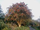 Rowan2.0 mi
Explorer Tom Rowan is in the middle of a fierce feud with the oak next door over who has the better view of the sunset. They’ve been…
More mountains and hills in County Donegal · All of County Donegal

What do you know about this place?Tap to add a comment or ask a question