
What is recorded here
From the National Monuments Service (Archaeological Survey of Ireland) record DG045-026
Places near here
Photo credits
- National Inventory of Architectural Heritage
- Richard Webb, Geograph · CC BY-SA 2.0
- Kenneth Allen, Wikimedia Commons · CC BY-SA 2.0
- Maker not stated on source page, commons.wikimedia.org
- Maker not stated on source page, www.pinterest.com
- Maker not stated on source page, www.tripadvisor.com.au
- Heikki.vesanto, Wikimedia Commons · CC BY-SA 4.0
- Maker not stated on source page, tr.pinterest.com
- Maker not stated on source page, www.tripadvisor.co.za
- Maker not stated on source page, ru.pinterest.com
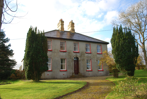 Ivy CottageHouse · 1569 yd
Explorer Tom Ivy Cottage was built around 1900 with a pair of stepped yellow-brick chimneys on the roof and a tall coloured-glass…
 Carrs Of The DiamondPub · 1.2 mi
Explorer Tom Carrs Of The Diamond sounds like a pub built on a rock that might roll away at any moment. Sit on the edge and enjoy…
 Meenatole National SchoolSchool · 1.2 mi
Explorer Tom Meenatole National School dates to 1897, as its sandstone plaque says. Behind it, a wall once separated the girls’ and…
 Bellanascaddan Food-Vessel Burial CistCist · 1.3 mi
Explorer Tom Bellanascaddan Food-Vessel Burial Cist is a tiny, square box, about 0.6m in size, that held a bowl and the cremated…
 Bellanascaddan Stone CistCist · 1.3 mi
Explorer Tom Bellanascaddan Stone Cist is officially recorded, yet we’re left guessing what actually sat inside those stones. It’s a…
 Standing stone in Gortnavern (gortnavern Ed)Standing stone · 1.3 mi
Explorer Tom Standing stone in Gortnavern had some cupmarks back in 1889 that seem to have vanished into the boggy ground. I bet…
 Carn Hill CairnCairn, unclassified · 1.3 mi
Explorer Tom Carn Hill Cairn is a heather-covered mound on the summit of Carn Hill with sweeping views. It’s cheeky that old maps…
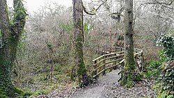 Ballyarr Nature ReserveNational nature reserve · 1.7 mi
Explorer Tom Ballyarr Wood has the lovely confidence of a place that does not need a castle, a cliff or a gift shop to make you…
 Ballykeeran Forest trailOfficial walking route · 2.0 mi
Explorer Tom Ballykeeran Forest trail in County Donegal used to be called 'The Path of Sighs' because people kept complaining about…
 Millbridge Bar and RestaurantPub · 2.4 mi
Explorer Tom Millbridge Bar and Restaurant is where locals complain about weather and prices with intense passion. It has a fierce…
 Kilmacrenan Friary GraveyardGraveyard · 2.6 mi
Explorer Tom “Kilmacrenan Friary Graveyard” in Kilmacrenan has a shortcut through the churchyard that locals swear saves ten minutes…
 Mapped graveyardGraveyard · 2.7 mi
Explorer Tom This unnamed graveyard in County Donegal has strict rules: no dogs, no hats, and definitely no talking about politics…
More archaeology and monuments in County Donegal · All of County Donegal

What do you know about this place?Tap to add a comment or ask a question