Places near here
Photo credits
- National Inventory of Architectural Heritage
- The Banner, Wikimedia Commons · CC BY-SA 4.0
- Colin Park, Geograph · CC BY-SA 2.0
- N Chadwick, Wikimedia Commons · CC BY-SA 2.0
- N Chadwick, Geograph · Creative Commons Attribution-ShareAlike 2.0
- NateBergin, Wikimedia Commons · CC BY 4.0
- Roger Diel, Wikimedia Commons · CC BY-SA 2.0
- Willow, Wikimedia Commons · CC BY 2.5
- Gordon Hatton, Geograph · CC BY-SA 2.0
- Joseph Mischyshyn, Geograph · CC BY-SA 2.0
- Eddylandzaat, Wikimedia Commons · CC BY 3.0
- WikiDon at English Wikipedia, Wikimedia Commons · CC BY-SA 3.0
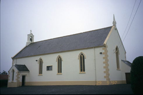 Saint Columba's Catholic ChurchChurch/chapel · 1.7 mi
Explorer Tom Saint Columba's Catholic Church in Teerleheen is pretending it’s ancient, but let's be honest, it’s just a posh 1846…
 Saint Attracta's Catholic ChurchChurch/chapel · 2.2 mi
Explorer Tom Saint Attracta's Church is a double-height building that probably echoes your every whisper back at you with judgment.…
 Burren Centre KilfenoraVisitor information · 3.0 mi
Explorer Tom The Burren Centre in Kilfenora is a sensible first stop before trying to make sense of north Clare's limestone hills. I…
 High CrossVisitor attraction · 3.0 mi
Explorer Tom High Cross was once offered for sale by a very confused cow who thought she could buy it with a bag of coins. She paid…
 Graveyard3.0 mi
Explorer Tom Graveyard in Kilfenora wraps around the cathedral with a rubble wall. There's a fairy dispute over parking rights at…
 Cathedral (in ruins)Cathedral · 3.0 mi
Explorer Tom Kilfenora Cathedral is having a bit of a feud with the next village over something daft like whose sheep ate whose…
 Caherminnaun Castle (in ruins)Castle, unclassified · 3.2 mi
Explorer Tom Caherminnaun Castle is basically a heap of rubbish that thinks it's a monument. O’Curry said it was 'a heap of ruins'…
 European ash3.7 mi
Explorer Tom European ash in County Clare was once used for smuggling whiskey, with bottles hidden inside its hollow trunk where no…
 Smithstown Castle (in ruins)Castle, tower house · 3.9 mi
Explorer Tom Smithstown Castle on a rocky outcrop is officially gone, but I swear it’s just napping. It thinks Dublin tourists are…
 Famine MemorialMemorial · 4.3 mi
Explorer Tom The Famine Memorial acts like it’s the guest at a wedding who stole the cake, standing there with its arms crossed in…
 SlievecallanMountain / peak · 7.7 mi
Explorer Tom Slievecallan is hiding its light under a bushel of winter frost, pretending it doesn't matter that nobody remembers the…
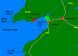 Liscannor BayBay · 8.5 mi
Explorer Tom Liscannor Bay is a great big Atlantic grin on County Clare's coast, with Liscannor village on one side and the sand at…
More archaeology and monuments in County Clare · All of County Clare

What do you know about this place?Tap to add a comment or ask a question