What is recorded here
In rough mountain grazing, on SW-facing slope. Circular area (27m E-W; 26m N-S) enclosed by collapsed stone wall (H c. 0.6m; T 5m) topped by stone field boundary SW->SE. Break (Wth 3m) in collapsed wall to N. Entrance (Wth 2.7m) to S; scatter of large stones outside entrance may be remains of chevaux-de-frise. Interior slopes gently down to S. Low foundations of stone wall form arc (N->S) abutting W wall of cashel, enclosing area 6m N-S x 4.6m E-W; Hartnett (1939, 71-2, Fig. XXIV) recorded two turf-covered mounds of stones (H c. 1ft), one to E and one to W of this wall; mound to W no longer survives. Similar arc (NE->SW) abuts NW wall of cashel enclosing area 6m NE-SW x 6m NW-SE; not recorded by Hartnett (ibid.), may be remains of sheep shelter. Paving of loose stones (Wth 3m) inside cashel wall in SE quadrant. Roofless chamber (3.3m x 1.8m) to E of entrance, abutting inside of cashel wall, defined by stone wall (H 1.2m); extends E as lower, narrower chamber (L 3m; Wth 0.9m; H 0.94m) roofed with lintels. Man-made underground passage (8917) in SW quadrant.
In rough mountain grazing, on SW-facing slope. Circular area (27m E-W; 26m N-S) enclosed by collapsed stone wall (H c. 0.6m; T 5m) topped by stone field boundary SW->SE. Break (Wth 3m) in collapsed wall to N. Entrance (Wth 2.7m) to S; scatter of large stones outside entrance may be remains of chevaux-de-frise. Interior slopes gently down to S. Low foundations of stone wall form arc (N->S) abutting W wall of…
From the National Monuments Service (Archaeological Survey of Ireland) record CO060-027001
The monument record does not grant public access. Check the route and ask the landowner before entering private land.
- What survives
- Recorded monument
Places near here
Photo credits
- Sole Origami, Wikimedia Commons · CC BY-SA 4.0
- Ceoil at English Wikipedia, Wikimedia Commons · CC BY-SA 3.0
- National Inventory of Architectural Heritage
- Jonathan Thacker, Wikimedia Commons · CC BY-SA 2.0
- Frederick Dean, Geograph · CC BY-SA 2.0
- Hywel Williams, Wikimedia Commons · CC BY-SA 2.0
- Corkonian2013, Wikimedia Commons · CC BY-SA 3.0
- Michael Earnshaw, Geograph · CC BY-SA 2.0
- Joebater at English Wikipedia, Wikimedia Commons · CC BY-SA 3.0
- Garry Dickinson, Wikimedia Commons · CC BY-SA 2.0
- Donald MacDonald, Geograph · CC BY-SA 2.0
 St John the Baptist Roman Catholic ChurchChurch/chapel · 2.1 mi
 Carrigagulla Stone CircleArchaeological place · 2.2 mi
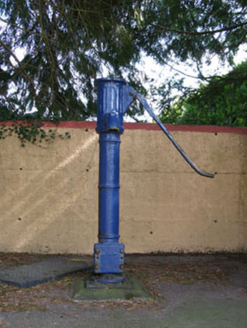 water pump2.2 mi
 MusheraMountain / peak · 4.0 mi
 Mullinhassig WaterfallWaterfall · 4.1 mi
.jpg/250px-St._Olan's_Well_-_geograph.org.uk_-_2832674_(cropped).jpg "Photo: Hywel Williams, Wikimedia Commons · CC BY-SA 2.0") St Olans WellHoly well · 4.2 mi
St Olans WellHoly well · 4.2 mi Mullinhassig WoodWood · 4.2 mi
 MusheramoreMountain / peak · 4.3 mi
 Battle of MacroomBattle · 5.0 mi
_-_geograph.org.uk_-_6529588.jpg/250px-Castles_of_Munster,_Macroom,_Cork_(1)_-_geograph.org.uk_-_6529588.jpg "Photo: Garry Dickinson, Wikimedia Commons · CC BY-SA 2.0") Macroom CastleCastle · 5.0 mi
Macroom CastleCastle · 5.0 mi Macroom Castle (in Ruins)Castle, tower house · 5.0 mi
 Carrigadrohid CastleHeritage attraction · 5.3 mi
More archaeology and monuments in County Cork · All of County Cork
What do you know about this place?