What is recorded here
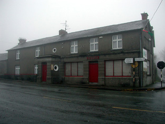
Butler in Raheenduff put the house and shop together, with a projecting porch giving the resident a grand little entrance of their own. A brave attempt at privacy in a building where somebody could shout through the wall, ‘Are you out of biscuits or just ignoring me?’
Detached six-bay two-storey double-pile house, post-1925, on a corner site incorporating fabric of earlier range, pre-1840, with single-bay single-storey flat-roofed projecting porch to centre ground floor, and shopfront to right ground floor. Now disused to right ground floor. Pitched double-pile (M-profile) slate roof with clay ridge tiles, red brick Running bond chimney stacks, and cast-iron rainwater goods on rendered eaves (overhanging to gables). Flat roof to porch not visible behind parapet. Unpainted rendered walls with channelling to porch supporting moulded course, frieze, moulded cornice having blocking course, panel to first floor side (north-east) elevation having rendered surround, and rendered 'timber frame' detailing to gables to side (north-east) elevation. Square-headed window openings with cut-stone sills, timber casement windows having decorative glazing patterns to casement sections, and six-over-six timber sash windows to rear (north-west) elevation. Oculus window openings to porch in round recesses and to first floor over porch having chamfered reveals, and fixed-pane timber windows. Square-headed door opening to porch with tongue-and-groove timber panelled door having overlight. Rendered shopfront to right ground floor on a symmetrical plan with channelled piers, fixed-pane (three-light) timber display windows, timber double doors having overlight, fascia having raised lettering, and moulded cornice. Road fronted on a corner site with sections of wrought iron railings to front having cast-iron finials, and concrete footpath to front of shopfront.
A well-composed middle-size range combining residential and commercial spaces in a wholly integrated design: although now disused the survival of a pleasant shopfront of artistic design interest maintains the integrity of the site. Elsewhere distinctive attributes ranging from the rendered dressings on the wall surface to the varied profiles of the openings all serve to enhance the architectural design value of the composition. An existing range having been reconstructed following an attack by the Black-and-Tans as part of the Irish Civil War (1922-3) the present house occupying a prominent corner site in the centre of the village forms an important element of the architectural heritage of The Rower.
From the Buildings of Ireland (National Inventory of Architectural Heritage) record 12324004
This does not grant access. Most recorded buildings are privately owned; view them only from public ground unless the owner allows entry.
Places near here
Photo credits
- National Inventory of Architectural Heritage
- liam murphy, Geograph · Creative Commons Attribution-ShareAlike 2.0
- Mike Searle, Wikimedia Commons · CC BY-SA 2.0
- A.-K. D., Wikimedia Commons · CC BY-SA 4.0
- Donald Hobern from Copenhagen, Denmark, Wikimedia Commons · CC BY 2.0
- Lisamoriarty1, Wikimedia Commons · CC BY-SA 4.0
- Sarah777, Wikimedia Commons · CC BY-SA 3.0
- Humphrey Bolton, Geograph · Creative Commons Attribution-ShareAlike 2.0
- Didier Descouens, Wikimedia Commons · CC BY-SA 4.0
- Sarah777, Wikimedia Commons · Public domain
- kevin higgins, Geograph · CC BY-SA 2.0
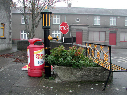 water pump19 yd
 The Rower ChurchChurch/chapel · 67 yd
 Coolhill Castle (in ruins)Castle, tower house · 1.3 mi
 The SpoutSpring · 2.5 mi
 Silver Wattle2.6 mi
 St. Mullins MoatCastle, motte and bailey · 2.7 mi
 St. MullinsHistoric town · 2.7 mi
 Graveyard in St. Mullin'sGraveyard · 2.7 mi
 St. Mullins WellHoly well · 2.8 mi
 Hawthorn3.5 mi
 Brandon HillMountain / peak · 3.9 mi
 Freney's WellSpring · 4.6 mi
More historic places in County Kilkenny · All of County Kilkenny
What do you know about this place?