
Places near here
Photo credits
- National Inventory of Architectural Heritage
- A.-K. D., Wikimedia Commons · CC0
- Miguel Angel Masegosa Martínez, Wikimedia Commons · CC BY 2.0
- Darrin Antrobus, Wikimedia Commons · CC BY-SA 2.0
- Mike Searle, Geograph · CC BY-SA 2.0
- Keith Weller, Wikimedia Commons · Public domain
- Hugh Chevallier, Wikimedia Commons · CC BY-SA 2.0
- kevin higgins, Wikimedia Commons · CC BY-SA 2.0
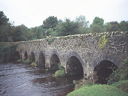 Kilbricken BridgeBridge · 1.5 mi
Explorer Tom Kilbricken Bridge was saved by a hero nobody remembers, probably because he was too busy trying to figure out how seven arches fit over the river Nore without falling in. The triangular cut-waters are doing all the heavy lifting here. Go back in winter, it's a different animal.
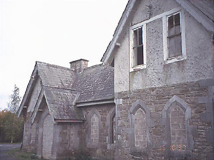 Mounthrath and Castletown Railway StationRailway station · 1.5 mi
Explorer Tom Mountrath Station is where the fiddler played all night and the train finally left without him. Derelict but still rocking on its gabled porches like it owns the place. Stop the car, it's worth the hazard lights.
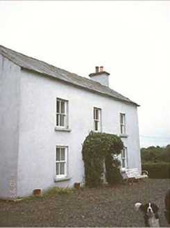 Kilbricken HouseHouse · 1.6 mi
Explorer Tom Kilbricken House is where a poet fell into the ditch nearby and wrote a sonnet about how bad his knees were, not the view. It’s got a conservatory now, so he can suffer in comfort from the cold. Ring your granny and tell her where you are.
 Aghaboe MoatCastle, motte and bailey · 1.9 mi
 Sweet Chestnut1.9 mi
Explorer Tom Sweet Chestnut in County Laois is hiding a treasure that is definitely just an old biscuit tin buried under its roots. You’ll dig it up and be disappointed, but worth it. Bring a camera and your most suspicious face.
 Font2.0 mi
Explorer Tom “Font in Aghaboe” hosted a fake royal visit that nobody can prove or deny to this day. It’s octagonal, which is fancy talk for “eight sides.” Spot the oldest stone and give it a name.
 Aghaboe AbbeyVisitor attraction · 2.0 mi
 St. Fintans WellHoly well · 3.3 mi
Explorer Tom St. Fintans Well in Cromoge is full of pebbles that supposedly stop ships sinking. I say they’re just rocks that got jealous of the ocean. Grab one if you dare, but don’t blame me if your boat capsizes. Sit on a wall near it and pretend you're in a painting.
 Ballygeehin Castle (in Ruins)Bawn · 3.9 mi
Explorer Tom Ballygeehin Castle in Ballygeehin Lower would teach history if it had to, but it’s too busy showing off its moat. It’s basically a giant stone hug for the castle next door. Bring someone who'll believe anything.
 European Pear4.9 mi
Explorer Tom European Pear in County Laois is playing hard to get, much like that cow who tried to buy it with a bad note. It’s probably judging your footwear right now. Ideal stop for a big stretch and a bigger yawn.
 ArderinMountain / peak · 9.2 mi
 BaunreaghcongMountain / peak · 9.3 mi
More mountains and hills in County Laois · All of County Laois

What do you know about this place?Tap to add a comment or ask a question