
What is recorded here
From the National Monuments Service (Archaeological Survey of Ireland) record MA119-059002
Places near here
Photo credits
- National Inventory of Architectural Heritage
- Maker not stated on source page, www.pinterest.com
- Maker not stated on source page, www.irelandhighlights.com
- Maker not stated on source page, uk.pinterest.com
- Maker not stated on source page, commons.wikimedia.org
- Maker not stated on source page, en.wikipedia.org
- Sitomon, Wikimedia Commons · CC BY-SA 2.0
- Mike Searle, Wikimedia Commons · CC BY-SA 2.0
- Kmcnamee, Wikimedia Commons · CC BY-SA 4.0
- Photographer not named, sylanehc.ie
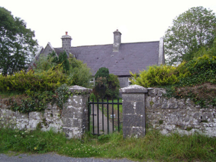 Cloghans National SchoolSchool · 347 yd
Explorer Tom Cloghans National School is dressed for a Victorian fancy dress party that hasn’t started yet. It’s got that grey…
 CastleCastle, unclassified · 1078 yd
Explorer Tom Castle in Cloghans Beg is playing hard to get. Its least favourite visitor was probably a very confused sheep that…
 Fairy fort / earthen ringfort in ArdourFairy fort / earthen ringfort · 1331 yd
Explorer Tom Fairy fort / earthen ringfort in Ardour has been quarried out at the north and southeast, so it’s half gone. The most…
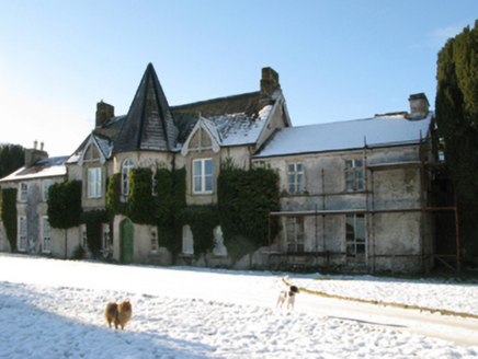 Cloghans HouseFarm house · 1525 yd
Explorer Tom Cloghans House in Cloghans Beg is sitting there looking all regal with its turret, acting like it’s a castle when it’s…
 Fairy fort / earthen ringfort in KilshanvyFairy fort / earthen ringfort · 1.1 mi
Explorer Tom Fairy fort / earthen ringfort in Kilshanvy would post 'still here' on social media, but the algorithm buried it under…
 Fairy fort / earthen ringfort in Ardour,kilshanvyFairy fort / earthen ringfort · 1.3 mi
Explorer Tom Fairy fort / earthen ringfort in Ardour, Kilshanvy is quadrangular, which makes it feel like it’s trying too hard to be…
 Castle (Site of)Gatehouse · 1.4 mi
Explorer Tom Castle at Blindwell is just a pointed arch with two hanging eyes, possibly for a bawn entrance. It flanks a wall with…
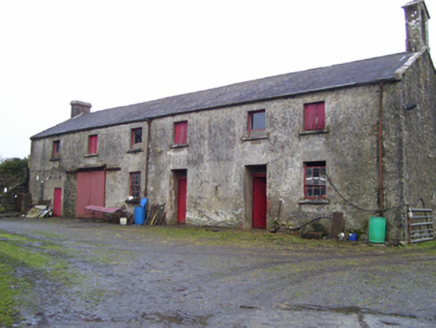 Blindwell HouseFarmyard complex · 1.4 mi
Explorer Tom Blindwell House’s farmyard complex was once ruled by a goat who thought it owned the limestone. The main house is gone…
 European Yew1.6 mi
Explorer Tom European Yew remembers the priest who lost a bet there and had to walk the whole way back home barefoot. It still looks…
 Fartamore Castle (ruins)Castle · 4.6 mi
Explorer Tom Fartamore Castle is in ruins, which means it’s officially allowed to look a bit messy without anyone complaining about…
 Kilconly GAAGAA ground · 5.2 mi
 Sylane Hurling GAA pitchGAA ground · 5.5 mi
More archaeology and monuments in County Mayo · All of County Mayo

What do you know about this place?Tap to add a comment or ask a question