What is recorded here
A burnt spread was recently identified by Dominic Delaney & Associates while carrying out archaeological monitoring between 10th-12th November 2021, in advance of afforestation at Stonestown, County Offaly. The report was prepared in compliance with the archaeological conditions attached to the Afforestation Licence…
Read the whole record
From the National Monuments Service (Archaeological Survey of Ireland) record OF022-031
Places near here
Photo credits
- Eric Jones, Geograph · CC BY-SA 2.0
- Maker not stated on source page, www.tripadvisor.ie
- Maker not stated on source page, www.rte.ie
- National Inventory of Architectural Heritage
- Maker not stated on source page, www.flickr.com
- Maker not stated on source page, www.dreamstime.com
- Sarah777 at English Wikipedia, Wikimedia Commons · Public domain
- Maker not stated on source page, www.dailymail.co.uk
- Maker not stated on source page, production.english-heritage.org.uk
 Cloghan HillMountain / peak · 1281 yd
Explorer Tom Cloghan Hill in Offaly thinks all tourists from Dublin are just lost actors looking for their next big break. It keeps…
 Church in KilcaminChurch · 1462 yd
Explorer Tom The Church in Kilcamin is so unlocated that even the seagulls have given up on finding it, which is rude. They probably…
 Cloghan, St Rynaghs FootballGAA ground · 1601 yd
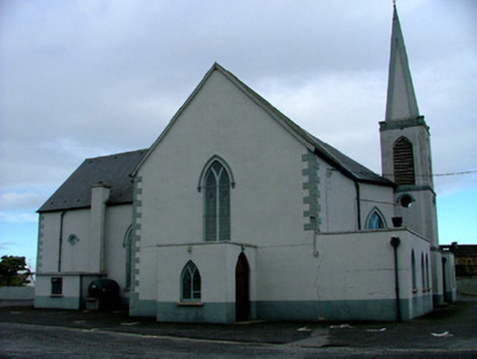 Saint Mary's Catholic ChurchChurch/chapel · 1747 yd
Explorer Tom Saint Mary's Catholic Church in Cloghan is having a bit of an identity crisis with its stained glass. It probably told…
 Lug Holy WellHoly well · 1.0 mi
Explorer Tom Lug Holy Well in Stonestown is hidden under bog on all sides, waiting for a zombie attack to survive. It was full of…
 weighbridge/weighhouse1.1 mi
Explorer Tom Weighbridge in Cloghan is sitting on the side of the green, remembering days when everyone had to step on it to see if…
 Killourney CemeteryCemetery · 1.8 mi
Explorer Tom Killourney Cemetery in County Offaly has a dating profile that just reads 'Looking for someone who respects my…
 Clonony CastleCastle, tower house · 2.7 mi
Explorer Tom Clonony Castle in Clonony More is playing hard to get, hiding in its rock outcrop like a shy elf. The locals swear…
Clonony Castle (in Ruins)Bawn · 2.7 miExplorer Tom Clonony Castle has a long list of former names that are all slightly embarrassing for its current status. The bawn wall…
 Mapped cemeteryCemetery · 3.3 mi
Explorer Tom Mapped cemetery in County Offaly once saw a dramatic scene where a very confused goose landed on a headstone and…
 TombTomb, chest tomb · 3.5 mi
Explorer Tom Tomb in Moystown Demesne belongs to Sárán, son of Brógán, who saved it from obscurity. The hero nobody remembers is…
 Cromwell's CastleHeritage attraction · 5.1 mi
Explorer Tom Cromwell's Castle is in a bit of a rivalry with a more famous castle nearby because it thinks its name sounds tougher…
More archaeology and monuments in County Offaly · All of County Offaly

What do you know about this place?Tap to add a comment or ask a question