What is recorded here
Burnt spread uncovered and fully excavated by Jonathan King under licence No. 16E0446 during development works for the Center Parcs Leisure development. In poorly drained area of coniferous plantation. Site identified as a sub-circular-shaped spread of burnt material (diam. 6.7m x D 0.14m) consisting of charcoal-rich soil and heart shattered stone. Excavation of the material revealed no cuts or troughs beneath the spread of burnt material.
Burnt spread uncovered and fully excavated by Jonathan King under licence No. 16E0446 during development works for the Center Parcs Leisure development. In poorly drained area of coniferous plantation. Site identified as a sub-circular-shaped spread of burnt material (diam. 6.7m x D 0.14m) consisting of charcoal-rich soil and heart shattered stone. Excavation of the material revealed no cuts or troughs beneath…
From the National Monuments Service (Archaeological Survey of Ireland) record LF027-059
The monument record does not grant public access. Check the route and ask the landowner before entering private land.
- What survives
- Recorded monument
Places near here
Craft WorkshopHeritage attraction · 74 ydGuest ServicesVisitor information · 116 ydBurnt spread in NewcastleBurnt spread · 130 ydFulacht fia in NewcastleFulacht fia · 386 yd NewcastleKiln · 742 ydNewcastleStables · 849 ydGoldsmith Birthplace, PallasVisitor information · 1211 ydBallymulvey HouseCastle, unclassified · 1.7 miSessile Oak2.3 miAbbeyshrule AbbeyRuins · 2.4 miCommon Lime2.6 miNot locatedCastle, unclassified · 3.1 mi
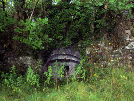 NewcastleKiln · 742 yd
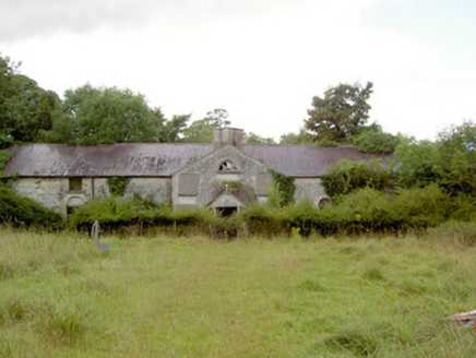 NewcastleStables · 849 ydGoldsmith Birthplace, PallasVisitor information · 1211 ydBallymulvey HouseCastle, unclassified · 1.7 mi
 Sessile Oak2.3 mi
 Abbeyshrule AbbeyRuins · 2.4 mi
 Common Lime2.6 miNot locatedCastle, unclassified · 3.1 mi
Pictures: National Inventory of Architectural Heritage; Maker named on the Wikimedia Commons picture page · CC BY-SA 2.5; Jamesco101, Wikimedia Commons · CC BY-SA 4.0; Alvesgaspar, Wikimedia Commons · CC BY-SA 3.0
More archaeology and monuments in County Longford · All of County Longford
What do you know about this place?