
What is recorded here
Archaeological testing carried out by Billy Quinn for IAC Ltd. under licence no. 03E1017 revealed an isolated burnt spread in Trench no. 8. An investigation of the deposit along its northern edge produced no finds. The burnt spread was defined by an anomalous charcoal enriched sandy silt deposit situated 3m from the…
Read the whole record
From the National Monuments Service (Archaeological Survey of Ireland) record DG109-008
Places near here
Photo credits
- Maker not stated on source page, www.pinterest.com
- Wanfried-Dublin, Wikimedia Commons · CC BY-SA 4.0
- Maker not stated on source page, en.wikipedia.org
- Maker not stated on source page, www.megalithic.co.uk
- National Inventory of Architectural Heritage
- Maker not stated on source page, www.flickr.com
- Maker not stated on source page, storage.googleapis.com
- Maker not stated on source page, www.historic-uk.com
- Kenneth Allen, Geograph · CC BY-SA 2.0
 Standing stone in MagheracarStanding stone · 471 yd
Explorer Tom The Standing stone in Magheracar is flat on its back, but those packing stones still hug its base like loyal friends.…
 Magheracar Wedge TombWedge tomb · 514 yd
Explorer Tom Magheracar Wedge Tomb sits just 50m from the coast, with a view stretching all the way to Ben Bulbin. Lhuyd’s party was…
 Linear earthwork in TullaghanLinear earthwork · 519 yd
Explorer Tom Linear earthwork in Tullaghan is just a ditch that thinks it’s a border and gets offended every time I ask. It’s been…
 Magheracar Passage TombPassage tomb · 591 yd
Explorer Tom Magheracar Passage Tomb sits right on the cliff edge, and half its mound has already fallen into the sea. It’s a…
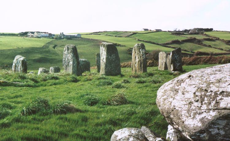 Stone circle in MagheracarStone circle · 595 yd
Explorer Tom The Stone circle in Magheracar is actually a mysterious semicircular platform with three concentric rings, barely six…
 folly, building misc723 yd
Explorer Tom Folly, Building misc in Magheracar sits on a cliff above Donegal Bay. A nineteenth-century account says one stone…
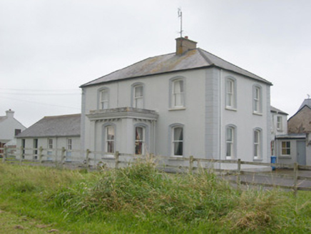 Villa NovaHouse · 1101 yd
Explorer Tom Villa Nova looks over Donegal Bay from its grounds near Bundoran. Built around 1880, it gives even its little entrance…
 Former Magheracar Church and Burial GroundGraveyard · 1120 yd
Explorer Tom The Former Magheracar Church and Burial Ground is basically just a bungalow now, which is a bit rude. But the owner has…
 Fairy fort / stone ringfort in DooballyFairy fort / stone ringfort · 1156 yd
Explorer Tom Fairy fort / stone ringfort in Doobally would write 'Seeking serious relationship, but I am very steep' on its dating…
 Duncarbry CastleCastle, tower house · 1585 yd
Explorer Tom Duncarbry Castle ended up here because someone made a mistake with the map or the land. It guarded the river gap, but…
 Duncarbry Castle (site of)Archaeological place · 1592 yd
Explorer Tom Duncarbry Castle is furious at the modern farm that replaced it, claiming it’s just a glorified goat shed now. It holds…
 Allingham ArmsHotel · 1.0 mi
Explorer Tom Allingham Arms at West End sounds like it has more arms than a spider, probably winning best decoration at the county…
More archaeology and monuments in County Donegal · All of County Donegal

What do you know about this place?Tap to add a comment or ask a question