
What is recorded here
Located in a boggy, pasture field which is crossed by several drains. To the north the ground rises to a ridge with frequent rock out-cropping. The N56 borders the S side of the field. This burnt spread was discovered in 2021 during archaeological testing of a proposed topsoil storage area for a road scheme on the N56…
Read the whole record
From the National Monuments Service (Archaeological Survey of Ireland) record DG065-019
Places near here
Photo credits
- Kenneth Allen, Wikimedia Commons · CC BY-SA 2.0
- Ronnie Nijboer, Wikimedia Commons · CC0
- Maker not stated on source page, www.pinterest.com
- Maker not stated on source page, ru.pinterest.com
- Maker not stated on source page, www.airbnb.co.za
- Maker not stated on source page, blog.irishtourism.com
- National Inventory of Architectural Heritage
- Rossographer, Wikimedia Commons
- louise price, Geograph · CC BY-SA 2.0
 Letterilly Standing StonePublicly named standing stone · 684 yd
Explorer Tom Letterilly Standing Stone is standing there all by itself, probably wondering why it didn't get invited to the more…
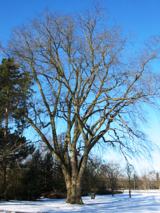 Wych Elm1.1 mi
Explorer Tom Wych Elm claims there’s a shortcut through its branches that saves twenty minutes, but nobody has ever actually found…
 Kilkenny Early Church EnclosureEcclesiastical enclosure · 1.2 mi
Explorer Tom Kilkenny Early Church Enclosure sits right on the edge of the sea, with a curving wall that’s mostly grassed over now.…
 Kilkenny Old Church GraveyardGraveyard · 1.2 mi
Explorer Tom Kilkenny Old Church Graveyard places a rectangle beside the remains of a curve: the survey described the rectangular…
 Dunnarealt FortIslet · 1.6 mi
Explorer Tom Dunnarealt Fort in County Donegal is currently being run by a very aggressive terrier who has never met a stranger he…
 Fairy fort / stone ringfort in Dunnarealt IslandFairy fort / stone ringfort · 1.6 mi
Explorer Tom Fairy fort / stone ringfort in Dunnarealt Island takes up the entire tiny island. There are two rectangular stone…
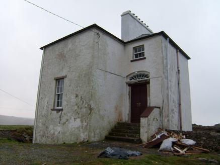 The Old RectoryRectory/glebe/vicarage/curate's house · 1.9 mi
Explorer Tom The Old Rectory built in 1828 has false windows on its front, which makes me think it’s just shy and doesn’t want…
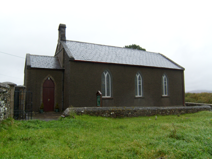 Lettermacaward ChurchChurch/chapel · 2.1 mi
Explorer Tom Lettermacaward Church dates to 1788, with a carved sandstone bell-cote and the remains of an older church nearby. I…
 Bonny Glen WoodForest recreation place · 2.4 mi
Explorer Tom Bonny Glen Wood has a name so cheerful I nearly expected it to greet me at the car park. Instead it gave me a little…
 DooeyOfficial bathing water · 4.1 mi
Explorer Tom Dooey Beach gives you three kilometres of Donegal sand and then dares you to say you have run out of room for a walk. I…
 Mapped graveyardGraveyard · 4.6 mi
Explorer Tom This unnamed graveyard in County Donegal took forty cups of tea to build, which explains why everyone who worked on it…
 IllannagallyIslet · 4.9 mi
Explorer Tom Illannagally in County Donegal refuses to fall down because it thinks gravity is a personal insult to its character and…
More archaeology and monuments in County Donegal · All of County Donegal

What do you know about this place?Tap to add a comment or ask a question