What is recorded here
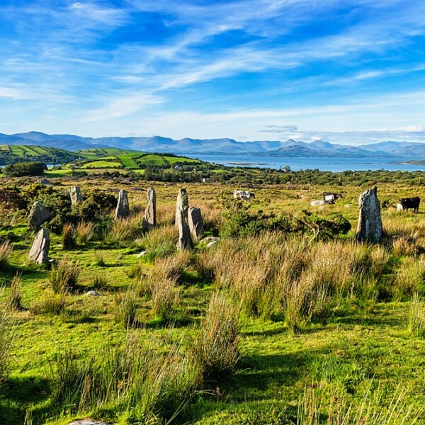
Ardgroom Outward holds two burnt mounds and a standing stone near the stream, proving the valley served human fire long before modern memory. The main mound keeps heat-shattered stones and charcoal under gorse, while a boulder and upright arc mark its edge like a forgotten altar. People may have heated water for cleaning, cooking or ritual beside the mountain slope. The chamber repeats that the valley is not empty, but crowded with discarded fire and human habit.
In rough hill pasture, on the E bank of a stream on the lower N-facing slopes of Tooreennamna Mountain. A D-shaped mound (7.1m N-S; straight S side: L 9.6m E-W; H 1.2m) of heat-shattered stones and charcoal-enriched soil, covered with grass and gorse bushes. A boulder is embedded in the S side of the mound and there is a short arc of upright stones 2m from its SW corner. Another burnt mound (CO102-041013-) lies 6m to the W and there is a standing stone (CO102-041008-) c. 50m to the SE.
The above description is derived from 'The Archaeological Inventory of County Cork. Volume 5' (Dublin: Stationery Office, 2009).
Date of upload: 22 December 2009
Burnt mound, likely dating to the Neolithic or early Bronze Age. These features are associated with ritual or industrial activities, such as heat-treated stone use in cooking or hide-scalding.
The monument record does not grant public access. Check the route and ask the landowner before entering private land.
- What survives
- Recorded monument
Places near here
 CairnCairn, unclassified · 254 yd
 Field boundary in Ardgroom OutwardField boundary · 345 yd
 Glashananinnaun Br.Bridge · 1727 yd
 CoomacloghaneMountain / peak · 1.0 mi
 Keeragh MountainMountain / peak · 1.4 mi
 Bird IslandIslet · 1.5 mi
 Cappul Bridgebridge · 1.7 mi
 Ardgroom Pulleen LoopWalking route · 2.2 mi
 Crane IslandIslet · 3.5 mi
 Beara WayWalking route · 3.6 mi
 Japanese cedarJapanese cedar · 4.0 mi
 Soft Tree-fernSoft Tree-fern · 4.0 mi