DDiscover AloneMapAbout

Burial in Glennamong

Burial
Computer-made picture that does not show Burial in GlennamongNot a photo of this monument
Computer-made picture. It does not show this monument. · Report the wrong picture

The monument record does not grant public access. Check the route and ask the landowner before entering private land.

What do you know about this place?Tap to add a comment or ask a question

What you write will be public.

What is recorded here

In rough, heather-covered, boulder-strewn upland terrain, on the E slope of Bengorm Mountain at the W end of the Nephin Beg mountain range. The remote and not easily accessible location chosen for these unusual burials is a dark, semi-subterranean cavity or chamber (c. 7m N−S; 3.5m E−W; max. H 1.45m) created naturally…

Read the whole record
In rough, heather-covered, boulder-strewn upland terrain, on the E slope of Bengorm Mountain at the W end of the Nephin Beg mountain range. The remote and not easily accessible location chosen for these unusual burials is a dark, semi-subterranean cavity or chamber (c. 7m N−S; 3.5m E−W; max. H 1.45m) created naturally beneath collapsed sandstone boulders. The walls and roof are formed by massive immovable boulders and slabs, tipping at random angles; the floor is similarly defined, but is also strewn with loose rubble of smaller stones. The chamber is accessed at its NE end by squeezing through a narrow gap between boulders. Human bones found in this natural boulder chamber were notified to the National Monuments Service in August 2016. Some bones had already been removed from the location. A rescue excavation (16E0456) was carried out in the same month to record and retrieve bones and other archaeological evidence which remained in situ; another small deposit of bone, found in February 2017, was excavated in March 2017 (Dowd and Lynch 2017). The excavation results indicate that a variety of complex funerary/ritual practises took place here over several centuries during the Neolithic period. Activities were focused on a roughly rectangular, earth-filled pit (1.4m N−S; 0.6m E−W; D 0.4m) located in the central part of the cramped low-ceilinged chamber. The base and W side of the pit were defined by a massive sloping boulder, and loose rubble appears to have been roughly manipulated into place to create the other three sides. A deposit of disarticulated human bones lay on the surface of the pit. Within the pit were two layers of silty, gravelly earth containing human bone fragments, charcoal and moderate quantities of quartz. A natural crevice in the boulder on the W side of the pit contained a concentration of human teeth, as well as other human bone fragments and charcoal; this pocket of material appears to have been deliberately inserted into the crevice. Two small, isolated deposits of human bone fragments lay outside the pit, one located 0.55m to S and one c. 0.8m to ENE. Both appear to have been placed in natural hollows between stones. Two pieces of quartz were found close to the N deposit. Pieces of quartz were also scattered throughout the chamber. Osteoarchaeological analysis indicates that the bones represent between 7-10 individuals: two older adults (45+ yrs, at least one male) and one younger adult (25-45 yrs); possibly a fourth adult; one adolescent (13-20 yrs), and possibly a second adolescent; one child (7-9 yrs), a younger child (3-5 yrs) and an infant (3-12 months). (Linda Lynch, Appendix 1, in Dowd and Lynch 2017). The bones are small in quantity; the majority are highly fragmented, unburnt and disarticulated. They do not represent burials in the traditional sense: there is no evidence of a complete individual; bones from several individuals are conmingled, and only a small percentage of each individual is present. Several skull fragments show evidence of having been broken while in a semi-fresh state (i.e. up to a year after death). Some bones show evidence of having been exposed to sunlight/weathering prior to deposition in the cave. The bones found lying on top of the pit exhibit a mineral-like crust from exposure to the micro-climate of the chamber, indicating that they had not been covered. No artefacts were found. Radiocarbon dating of bone samples from four individuals produced dates (calibrated to two sigma) which span the entire Neolithic period: adult (from crevice in side of pit) Early-Middle Neolithic, 3620-3350 cal BC adult (from small deposit to S of pit) Middle Neolithic, 3500-3120 cal BC juvenile (7-9yrs) (bone on surface of pit) Late Neolithic, 2860-2495 cal BC juvenile (3-5 yrs) (bone on surface of pit) Late Neolithic/Early Bronze Age, 2575-2345 cal BC. The excavation results give rise to an interesting and unusual range of possible interpretations. One possibility is that the boulder chamber was used as a location for the excarnation/defleshing of corpses. In such a scenario, bodies were deposited in the boulder chamber to allow the soft tissue to decay naturally. The site would then have been periodically revisited, and certain dry bones selected and removed for burial elsewhere. However, other ritual practices may also have taken place. For instance, the presence of weathered bones suggests dry, disarticulated bones were brought into the chamber as token ritual deposits, and the breakage of skulls when still semi-fresh may also point to deliberate post-mortem ritual practice. Quartz occurs naturally in the local geology, but it seems likely that the quartz pieces found in association with the bones were deliberately deposited. Small quantities of charcoal found on a natural stone ledge hint at the use of wooden torches to illuminate the space. The dating evidence suggests the long-term importance of this natural boulder chamber, with the secrets of its remote location and complex ritual usage passed down from generation to generation. However, a shorter timeframe must also be allowed for, as some of the dated bones may have been taken from old family burial sites elsewhere, and brought into the cave. (Dowd and Lynch 2017). Attached images: MA057-005----_01.JPG Interior of natural boulder chamber MA057-005----_02.JPG Deposit of human bones MA057-005----_03.JPG Remote upland location Compiled by: Jane O'Shaughnessy Date of revised upload: 22 January 2017

From the National Monuments Service (Archaeological Survey of Ireland) record MA057-005

Places near here

Photo credits
  • Colin Park, Geograph · CC BY-SA 2.0
  • Maker not stated on source page, en.wikipedia.org
  • National Inventory of Architectural Heritage
  • Maker not stated on source page, extremenomads.life
  • Maker not stated on source page, ph.pinterest.com
  • Maker not stated on source page, ru.pinterest.com
  • Maker not stated on source page, www.gettyimages.com
  • Maker not stated on source page, www.tripadvisor.ca
  • Maker not stated on source page, www.irelandhighlights.com
  • Maker not stated on source page, www.pinterest.com
BengormMountain / peak · 542 yd

Explorer Tom Bengorm is doing that thing where it stands perfectly still but feels like it’s about to lunge at your ankles. Rumor…

Standing stone in GlennamongStanding stone · 1.5 mi

Explorer Tom Standing stone in Glennamong is the subject of endless seagull commentary about how it looks ridiculous when the wind…

CorranabinniaMountain / peak · 2.2 mi

Explorer Tom Corranabinnia rises out of Mayo's Nephin Begs like a mountain that has misplaced the road, the signposts and several…

Raigh LodgeFarm house · 3.8 mi

Explorer Tom Raigh Lodge in Raigh is writing itself a dating profile right now: ‘Views of Rockfleet Bay, no drama, seeks serious…

Rossturk IslandIslet · 4.2 mi

Explorer Tom Rossturk Island in Mayo is rumored to have a tunnel straight to the pub, but I think that’s just wishful thinking. The…

bridge4.3 mi

Explorer Tom Bridge in Kiltarnaght would say 'I have excellent references' in a job interview, pointing to its sturdy rock-faced…

Cross-inscribed stone in Aghadooey GlebeCross-inscribed stone · 4.3 mi

Explorer Tom Cross-inscribed stone in Aghadooey Glebe took about forty cups of tea to build, give or take. It’s just standing there…

Illannambraher WestIslet · 4.4 mi

Explorer Tom Illannambraher West refuses to fall down because it thinks gravity is just a suggestion made by people who aren't…

InishlimIslet · 4.4 mi

Explorer Tom Inishlim is basically the sheep’s personal playground, or at least that’s what they think. They probably vote for it as…

InishtubbridIslet · 4.5 mi

Explorer Tom Inishtubbrid had the time when a fox took full charge of the island and started collecting taxes from the gulls. The…
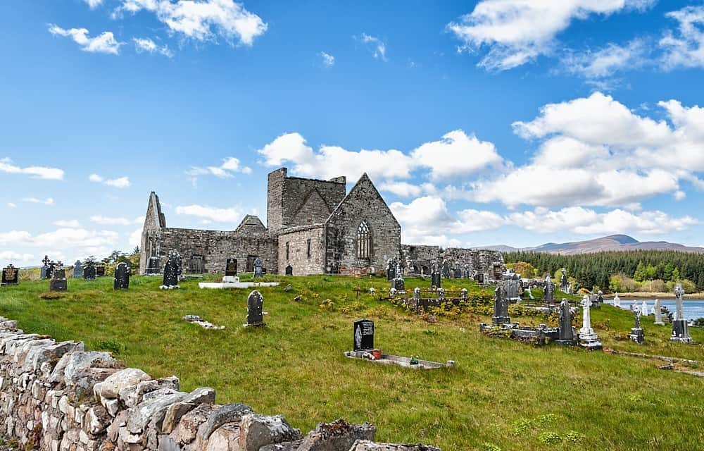
Burrishole Abbey WalkWalking route · 4.8 mi

Explorer Tom Burrishole Abbey Walk is famous for a tunnel that supposedly goes straight to the local pub, but nobody has found it…

CastleCastle, unclassified · 6.4 mi

Explorer Tom Castle in Carrickaneady is complaining to the council about how no one visits it anymore, which is a bit rich given its…

More archaeology and monuments in County Mayo · All of County Mayo

Add to this placeAdd a picture Add a detailed tip Add a story

Explore the map1,095,414 places to discover

Next place · or swipeBengorm