
Places near here
Photo credits
- Rod Allday, Wikimedia Commons · CC BY-SA 2.0
- John Darcy, Wikimedia Commons · CC BY-SA 2.0
- National Inventory of Architectural Heritage
- Oliver Dixon, Geograph · CC BY-SA 2.0
- Raymond Bell, Geograph · CC BY-SA 2.0
- Willie Duffin, Geograph · Creative Commons Attribution-ShareAlike 2.0
- NiallPFlynn, Wikimedia Commons · CC BY-SA 4.0
- Hollywelltrees, Wikimedia Commons · CC BY-SA 4.0
- Michael Murtagh, Geograph · CC BY-SA 2.0
 Parke's CastleVisitor attraction · 1.1 mi
Explorer Tom Parke's Castle has very strong opinions on modern buildings, specifically that they all look like giant plastic toys dropped by confused aliens from the future. It’s a ruin that judges your architecture choices from the shadows. Tell the next person you meet it's haunted. It might be.
 CastleCastle, tower house · 1.1 mi
Explorer Tom Castle in Kilmore would win the county fair for best dressed, even if it’s missing its hat. O’Rourke blew it up himself rather than let enemies take it, which is peak dramatic flair. Whisper a secret at it, it's kept worse.
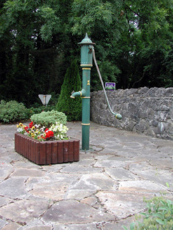 water pump1.6 mi
Explorer Tom Water pump in Drumahaire is whispering a secret code in its stones that only geese can understand. It’s retired now, but it still thinks it’s the king of hydration in this village. Just tap it gently and say 'thank you for the water,' even though you’re drinking from a plastic bottle.
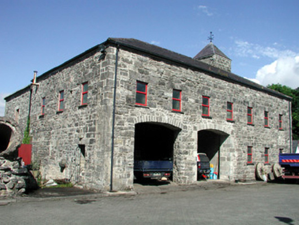 mill (water)1.6 mi
Explorer Tom Mill in Drumahaire is still grinding its heels against the weather, holding a grudge that goes back centuries over damp socks and wet grain. It’s a stone giant with a cast-iron gate, looking like it wants to sue the clouds for emotional distress. The tower is just there to watch you sweat while you wonder if the flour ever actually got ground.
 Trawane BayBay · 1.9 mi
Explorer Tom Trawane Bay in County Sligo would tell the interviewer it has excellent communication skills, which is a lie because it just waves at everyone. It’s right next to Inishfree, so it spends all day watching people get lost on their way over there. Count the crows, then count them again to be sure.
 InnisfreeIslet · 2.0 mi
Explorer Tom Innisfree is putting on a massive show for Yeats' ghost, but honestly, its dating profile just says 'small, moody, and I own a poem.' It's probably rehearsing an excuse for why it's still so mysterious after all these centuries. Ideal place to rehearse an excuse for being late.
 Grave YardGraveyard · 2.5 mi
Explorer Tom Graveyard in Killerry hates tourists who trip over its own headstones. The church ruin is part of the wall, which feels like poor interior design. Ideal stop for a big stretch and a bigger yawn.
 Court Tomb TrailWalking route · 3.1 mi
Explorer Tom Court Tomb Trail has been renamed so many times that even the stones are confused about their own identity. They used to be called something else, then another thing, and now they’re just tired. Tell the kids it's a castle. Close enough for anyone under ten to believe the ghost story.
 Giants GraveCourt tomb · 3.3 mi
Explorer Tom Giants Grave in Magheraghanrush refuses to fall down because it thinks the giants are still watching from the clouds. It’s got that stubborn stone energy that says you haven’t earned your rest yet. Snap one photo, then put the phone away and actually look.
 Church IslandIslet · 3.3 mi
Explorer Tom Church Island has been asked if it actually has a church, and honestly, it’s gotten a bit fed up with the constant theological debate. It just wants to be left alone to rot in peace. Perfect detour when the satnav has a meltdown.
 Keelogyboy MountainMountain / peak · 3.4 mi
Explorer Tom Keelogyboy Mountain and the nearest tree are having a massive drama about who gets to cast the better shadow. The mountain is winning so far, but the tree isn’t giving up without a fight over the sunlight rights. It’s like watching two uncles argue at a barbecue, except with more rocks involved. Stick around for the light changing, it's a show.
 Keelogyboy Mountain ne TopMountain / peak · 3.5 mi
Explorer Tom Keelogyboy Mountain NE Top has been hiding a scandal involving a missing chalice for centuries, and it's getting quite heavy on its conscience now. It looks a bit guilty if you stare at it too long from the right angle. Have a wander and a wonder.
More archaeology and monuments in County Leitrim · All of County Leitrim

What do you know about this place?Tap to add a comment or ask a question