
What is recorded here
From the National Monuments Service (Archaeological Survey of Ireland) record WI034-017
Places near here
Photo credits
- Maker not stated on source page, ru.pinterest.com
- Maker not stated on source page, en.wikipedia.org
- Golfing in Ireland; photographer not stated, Source publisher
- National Inventory of Architectural Heritage
- Maker not stated on source page, www.flickr.com
- Maker not stated on source page, br.pinterest.com
- Maker not stated on source page, ie.polomap.com
- Maker not stated on source page, www.irelandhighlights.com
- Maker not stated on source page, www.pinterest.com
- Anna Maria 4574, Wikimedia Commons · CC BY-SA 4.0
 Megalithic structure in ThreewellsMegalithic structure · 1 yd
Explorer Tom Megalithic structure in Threewells is where a priest once lost a bet about whether a giant actually lived there or not.…
 Bullaun stone in ThreewellsBullaun stone · 618 yd
Explorer Tom Bullaun stone in Threewells is claimed by a local who says he invented it himself. It used to be part of a wall but now…
 Macreddin Golf ClubGolf course · 1751 yd
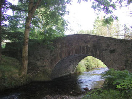 Macreddin BridgeBridge · 1.0 mi
Explorer Tom Macreddin Bridge is a picturesquely sited structure with a wooded backdrop that blends well with its surroundings. It’s…
 Fairy fort / earthen ringfort in Crone BegFairy fort / earthen ringfort · 1.1 mi
Explorer Tom Fairy fort / earthen ringfort in Crone Beg is so sick of people asking if it has an entrance that it’s considering…
 Enclosure in CronawinniaEnclosure · 1.2 mi
Explorer Tom Enclosure in Cronawinnia has been hiding a scandal since 1838, probably involving a very important cow and a missing…
 Saint Brigid's rc ChurchRuins · 1.2 mi
Explorer Tom Saint Brigid's RC Church in County Wicklow is incredibly proud of its stained glass window that lets in exactly one ray…
 Carysfort Castle (Site of)Fortification · 1.2 mi
Explorer Tom Carysfort Castle’s name really means 'Where Cary Forgot His Hat,' which sounds far more honest than any official…
 Megalithic structure in Crone BegMegalithic structure · 1.3 mi
Explorer Tom Megalithic structure in Crone Beg hosted a dance that went too far and broke the stones. The cromleach and fort are now…
 Aughrim National SchoolSchool · 1.5 mi
Explorer Tom Aughrim National School would order a huge portion of chips and gravy with an extra side of nostalgia in a chipper. The…
 Catholic Church of the Sacred HeartChurch/chapel · 1.6 mi
Explorer Tom Catholic Church of the Sacred Heart in Aughrim Lower once saw a vicar drop his tea tray during a thunderstorm, and it…
 Aughrim MillsGates/railings/walls · 1.6 mi
Explorer Tom Aughrim Mills in Aughrim Lower would introduce itself as the bouncer who lost his keys but still acts like he owns the…
More archaeology and monuments in County Wicklow · All of County Wicklow

What do you know about this place?Tap to add a comment or ask a question