What is recorded here
Situated in flat pasture, immediately N of the townland boundary with Milltown. Archaeological monitoring for a pipeline was carried out to the immediate west of the site in 2003 and this resulted in the identification of a number (approx. 13) human burials (Kehoe 2003; Licence No. 02E1281). The location of the burials is circled in yellow in Figure 1, based on the photographs of the site presented in the monitoring report. These remains, although very poorly preserved, were discovered in-situ and as such represent a historic burial ground of likely early medieval date. The full extent of the burials was not recorded, so it is likely that more survive, albeit in an extremely poor condition. Kehoe, H. 2002 Lucan-Palmerstown Pipeline High Level Water Supply Scheme. Archaeological Monitoring Report: Licence No. 02E1281. Unpublished report submitted to the National Monuments Service.
Situated in flat pasture, immediately N of the townland boundary with Milltown. Archaeological monitoring for a pipeline was carried out to the immediate west of the site in 2003 and this resulted in the identification of a number (approx. 13) human burials (Kehoe 2003; Licence No. 02E1281). The location of the burials is circled in yellow in Figure 1, based on the photographs of the site presented in the…
From the National Monuments Service (Archaeological Survey of Ireland) record DU017-108
The monument record does not grant public access. Check the route and ask the landowner before entering private land.
- What survives
- Recorded monument
Places near here
Photo credits
- Ashnazgul, Wikimedia Commons · CC BY-SA 4.0
- National Inventory of Architectural Heritage
- JP, Geograph · CC BY-SA 2.0
- Sitomon, Wikimedia Commons · CC BY-SA 2.0
- jwd, Geograph · CC BY-SA 2.0
- Mike Searle, Geograph · CC BY-SA 2.0
 Gollierstown BridgeBridge · 336 ydEarthwork in GollierstownEarthwork · 540 ydEnclosure in Loughtown UpperEnclosure · 705 yd
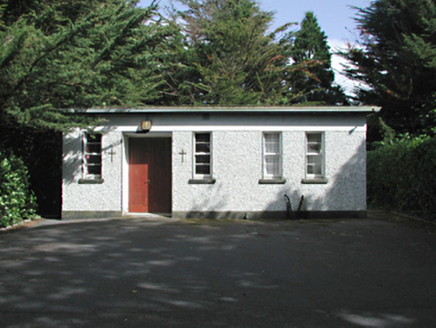 church/chapel844 yd
 Grand Canal WayWalking route · 1708 ydCastle (site of)Castle, unclassified · 1.0 miSaint Wolstan'sHeritage attraction · 2.0 mi
 European Yew2.0 mi
 Griffeen Valley WalkWalking route · 2.1 miBatty Langley WoodsForest · 2.1 mi
 CastleCastle, tower house · 2.3 miSaint Finian's WellSpring · 2.4 mi
More archaeology and monuments in County Dublin · All of County Dublin
What do you know about this place?