What is recorded here
Burial ground consisting of two extended skeletons orentated on an E-W axis and five skulls belonging to similar burials were uncovered by Dominic Delany in 1997 under licence no. 97U0001 during archaeological monitoring of topsoil stripping in advance of a proposed development at Croghan Demesne. Burial ground was located on S facing slope of rising ground in upland area with good views to the S, E and W, higher ground immediately to N. Nearby holy well known as Finnrenashark holy well (OF010-012----) located 34m to SE and second holy well (OF010-011----) located 167m to WSW. At least seven burials orientated on an E-W axis were uncovered at a depth of 0.3m below the surface of the ground. The disarticulated skeletal remains of other burials were also uncovered. The development was relocated to an adjoining field and the burial ground was backfilled and preserved in situ.
Burial ground consisting of two extended skeletons orentated on an E-W axis and five skulls belonging to similar burials were uncovered by Dominic Delany in 1997 under licence no. 97U0001 during archaeological monitoring of topsoil stripping in advance of a proposed development at Croghan Demesne. Burial ground was located on S facing slope of rising ground in upland area with good views to the S, E and W, higher…
From the National Monuments Service (Archaeological Survey of Ireland) record OF010-486
The monument record does not grant public access. Check the route and ask the landowner before entering private land.
- What survives
- Recorded monument
Places near here
Finnrenashark Holy WellSpring · 50 ydHoly Well155 ydCroghan Hill WalkVisitor information · 268 yd post box280 ydCroghan Hill WalkWalking route · 362 ydCroghan HillMountain / peak · 580 ydOConor Falys or Croghan Castle (in ruins)House, fortified house · 906 ydSaint Brigid's Catholic ChurchChurch/chapel · 1135 ydCastleCastle, unclassified · 1.4 miHoly PlantationForest · 3.0 miVictoria PlantationWood · 3.0 miDownan Grave YardGraveyard · 4.5 mi
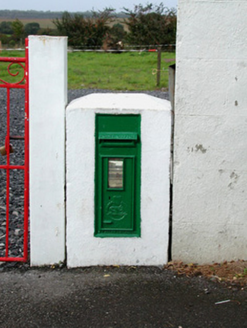 post box280 ydCroghan Hill WalkWalking route · 362 yd
 Croghan HillMountain / peak · 580 ydOConor Falys or Croghan Castle (in ruins)House, fortified house · 906 yd
 Saint Brigid's Catholic ChurchChurch/chapel · 1135 ydCastleCastle, unclassified · 1.4 miHoly PlantationForest · 3.0 miVictoria PlantationWood · 3.0 mi
 Downan Grave YardGraveyard · 4.5 mi
Pictures: National Inventory of Architectural Heritage; Sarah777 at en.wikipedia, Wikimedia Commons · Public domain; Dylan Moore, Wikimedia Commons · CC BY-SA 2.0; Kenneth Gallery Smyth, Geograph · Creative Commons Attribution-ShareAlike 2.0
More archaeology and monuments in County Offaly · All of County Offaly
What do you know about this place?