
What is recorded here
Situated on a slight break in a SW-facing slope, in undulating pastureland. Identified on an aerial photograph taken in June 1973 (GSIAP, S 466/7) as a roughly square area partially defined by a kink in the field boundary. The site consists of a raised platform (c. 34m N-S; 20m E-W) with a gently sloping scarp (H…
Read the whole record
From the National Monuments Service (Archaeological Survey of Ireland) record TN041-058
Places near here
Photo credits
- Maker not stated on source page, commons.wikimedia.org
- National Inventory of Architectural Heritage
- Sarah777, Wikimedia Commons · Public domain
- Maker not stated on source page, tr.pinterest.com
- Maker not stated on source page, www.tripadvisor.com.ph
- Maker not stated on source page, www.pinterest.com
- dougf, Wikimedia Commons · CC BY-SA 2.0
- Upperchurch Drombane GAA / Tipperary GAA club profile; aerial photographer not named, tipperary.gaa.ie
- Maker not stated on source page, stock.adobe.com
- Maker not stated on source page, www.dreamstime.com
 Enclosure in FertianaEnclosure · 1.1 mi
Explorer Tom Enclosure in Fertiana is the only dry spot in a marsh that floods every winter like a bad sitcom. Imagine a matchmaker…
 Saint Michael's Catholic ChurchChurch/chapel · 1.8 mi
Explorer Tom Saint Michael's Catholic Church in Holycross refuses to fall down because it knows its own worth. The gable front is so…
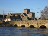 Holycross AbbeyChurch · 1.9 mi
Explorer Tom Holycross Abbey claims to have a piece of the True Cross, which is a bold move when you consider how many fakes are out…
 Fairy fort / earthen ringfort in KillinaneFairy fort / earthen ringfort · 1.9 mi
Explorer Tom Fairy fort / earthen ringfort in Killinane had a dramatic incident where a goat fell in and got stuck for three hours.…
 Holycross Abbey (in ruins)Religious house, Cistercian monks · 1.9 mi
Explorer Tom Holycross Abbey on the River Suir is playing hard to get with that massive Cistercian history hanging over its head. It…
 Holycross HousePresbytery/parochial/curate's house · 1.9 mi
Explorer Tom Holycross House is standing next to an abbey and acting like it’s the main event, which is cheeky considering the monks…
 Old MillMill (water) · 1.9 mi
Explorer Tom Old Mill would order a triple chipper with extra vinegar and no apologies. It’s been grinding grain since the…
 Castle (in ruins)Castle, tower house · 1.9 mi
Explorer Tom Ballynahow Castle is standing there looking suspiciously round, probably because it knows everyone has been staring at…
 Ballynahow CastleCastle · 1.9 mi
Explorer Tom Ballynahow Castle has made its New Year's resolution to finally fix that mural stairway so it doesn’t look like a…
 Upperchurch Drombane GAA pitchGAA ground · 3.6 mi
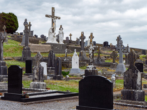 Kilvalure CemeteryGraveyard · 3.7 mi
Explorer Tom Kilvalure Cemetery would review its own visitors as 'adequate' but lacking in enthusiasm, which is harsh considering…
 Templebeg CemeteryCemetery · 4.0 mi
Explorer Tom Templebeg Cemetery would teach history by pointing at rocks and saying that’s all you need to know. It’s surprisingly…
More archaeology and monuments in County Tipperary · All of County Tipperary

What do you know about this place?Tap to add a comment or ask a question